CNIG - Instituto Geográfico Nacional
Wegen-, wandel-, en topografische kaarten van elk deel van Spanje, zeer gedetailleerd
Daarnaast geeft het CNIG een aantal goede wandelkaarten uit van de Nationale Parken in Spanje zoals het Parque Nacional Ordesa en Picos de Europa.
 Topografische kaart 795-I Xàtiva | CNIG - Instituto Geográfico Nacional
 795-II Real de Gandía | CNIG - Instituto Geográfico Nacional
 Topografische kaart 795-IV Villalonga | CNIG - Instituto Geográfico Nacional
 Topografische kaart 796-I Gandia | CNIG - Instituto Geográfico Nacional
 Topografische kaart 796-III Oliva | CNIG - Instituto Geográfico Nacional
 Topografische kaart 796-IV Dénia | CNIG - Instituto Geográfico Nacional
 Topografische kaart 798-I Sant Antoni de Portmany (Ibiza) | CNIG - Instituto Geográfico Nacional
 Topografische kaart 798-II Sant Rafel (Ibiza) | CNIG - Instituto Geográfico Nacional
 Topografische kaart 798-III Es Cubells (Ibiza) | CNIG - Instituto Geográfico Nacional
 Topografische kaart 798-IV Eivissa (Ibiza) | CNIG - Instituto Geográfico Nacional
 Topografische kaart 799 MT50 Santa Eulalia del Río (Ibiza) | CNIG - Instituto Geográfico Nacional
 Topografische kaart 799-I Santa Eulària des Riu (Ibiza) | CNIG - Instituto Geográfico Nacional
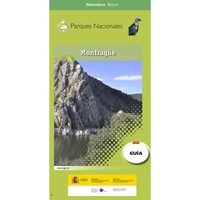 Wandelkaart 8 Parques Nacionales Montfrague, Extremadura | CNIG - Instituto Geográfico Nacional
Nationaalpark Extremadura Parque Nacional de Montfragüe is een set van wandelgids en zeer gedetailleerde wandelkaart 1:25.000 van het Nationale Park Mont Frague, Torrejon el Rubio in zuid Spanje, Extremadura (noordoostelijk …
★★★★★★★★★★ Topografische kaart 80-I Oseja de Sajambre | CNIG - Instituto Geográfico Nacional
 Klimgids 80-III Maraña | CNIG - Instituto Geográfico Nacional
 Topografische kaart 807-I Peñalsordo | CNIG - Instituto Geográfico Nacional
 Topografische kaart 807-II Chillón | CNIG - Instituto Geográfico Nacional
 Topografische kaart 821 MT50 Alcoy/Alcoi | CNIG - Instituto Geográfico Nacional
 Topografische kaart 821-I Muro de Alcoy | CNIG - Instituto Geográfico Nacional
 Topografische kaart 822-I Orba | CNIG - Instituto Geográfico Nacional
Laatste reviews

De ontvanger was er blij mee en gaat er zeker van genieten
★★★★★ door Jan vanVondel 17 februari 2025 | Heeft dit artikel gekocht
Prima verlopen allemaal Alles was naar wens
★★★★★ door Maurice 17 februari 2025 | Heeft dit artikel gekocht
Fijne boekjes van de ANWB om de vakantie voor te bereiden. Veel nuttige en leuke informatie over het gebied. Handig klein landkaartje los er bij. …
★★★★★ door Edwin 17 februari 2025 | Heeft dit artikel gekocht
Ik gebruik altijd deze kaarten van Michelin op vakantie. Schaal is 1 op 150000. Die zijn ideaal. Net het juiste detail-niveau. Alles wat je moet …
★★★★★ door Edwin 17 februari 2025 | Heeft dit artikel gekocht