Collins
Maak je reis compleet met de handige reisgidsen en wegenkaarten van Collins
 Wegenkaart - landkaart National Park Pocket Map Northumberland | Collins
Handige kleine kaart van dit Nationaal Park. De kaart geeft een goed en helder overzicht van het gebied met alle plaatsen, doorgaande wandelpaden (alhoewel grof van schaal), bezienswaardigheden etc. Met …
 Wegenkaart - landkaart National Park Pocket Map North York Moors | Collins
Handige kleine kaart van dit Nationaal Park. De kaart geeft een goed en helder overzicht van het gebied met alle plaatsen, doorgaande wandelpaden (alhoewel grof van schaal), bezienswaardigheden etc. Met …
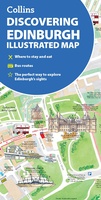 Stadsplattegrond Discovering Edinburgh Illustrated Map | Collins
Explore new places with dependable maps from Collins. This brand new edition retains the delightful water-colour mapping, with individual paintings of all the main sights and landmarks. This brand …
 Wandelgids Short Walks in the Peak District | Collins
A brand new range of practical little walk guides endorsed by the Ramblers. All the walks are 5 miles or under in length and can easily be completed in less …
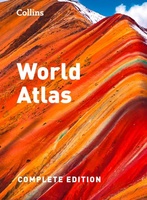 Atlas World Atlas complete | Collins
 Wegenkaart - landkaart Pocket Map Devon | Collins
Handy little full colour map of Devon. Main features of this map include: • Clear mapping • Main tourist attractions located and described • Ideal for touring with sights, …
 Wandelgids Park Rangers Favourite Walks Pembrokeshire Coast | Collins
The perfect companions for exploring the National Parks. Walking guide to the Pembrokeshire Coast National Park, with 20 best routes chosen by the park rangers. Each walk varies in length …
 Wandelgids Oxford | Collins
 Wegenkaart - landkaart Touring Map of Scotland - Schotland | Collins
Best-selling map of Scotland. More than 1,000 places of tourist interest plotted and named on the map. The features have been plotted onto an up-to-date and attractive Collins map of …
★★★★★★★★★★ Wegenkaart - landkaart National Park Pocket Map Yorkshire Dales | Collins
Handige kleine kaart van dit Nationaal Park. De kaart geeft een goed en helder overzicht van het gebied met alle plaatsen, doorgaande wandelpaden (alhoewel grof van schaal), bezienswaardigheden etc. Met …
★★★★★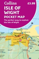 Wegenkaart - landkaart Pocket Map Isle of Wight | Collins
Handzame wegenkaart voor Isle of Wight. Handy little full-colour map of the Isle of Wight. Detailed mapping and tourist information of the whole island. With its stunning sea views …
 Wandelgids Park Rangers Favourite Walks South Downs | Collins
Compacte wandelgids met 20 wandelingen geselecteerd door park rangers en met duidelijke beschrijvingen en routekaartjes. Walking guide to the South Downs National Park, with 20 best routes chosen by …
 Wegenkaart - landkaart Pocket Map Cotswolds | Collins
Handy little full colour map of the Cotswolds. Main features of this map include: • Clear mapping • Main tourist attractions located and described • Ideal for touring with …
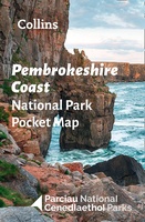 Wegenkaart - landkaart National Park Pocket Map Pembrokeshire Coast | Collins
Duidelijke pocket wandelkaart met belangrijke toeristische informatie, bezienswaardigheden, campeerplekken e.d. Handy little full colour map and guide of Pembrokeshire Coast National Park. Detailed mapping and visitor information to the National …
★★★★★ Wandelgids London Hidden Walks | Collins
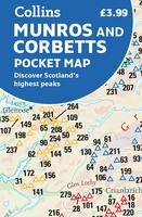 Wegenkaart - landkaart Pocket Map Munros and Corbetts | Collins
 Atlas The Times Concise Atlas of the World | Collins
Het kleinere zusje van de grotere comprehensive atlas, maar nog steeds een imposante dikke verschijning! Gedetailleerde en prachtig uitgevoerde kaarten presenteren de perfecte combinatie van traditie, kennis en stijl. De …
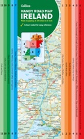
 Wegenkaart - landkaart Pocket Map Ireland pocket map - Ierland | Collins
Kleine handzame kaart van Ierland. Explore Ireland with this handy, full colour map. Handy little full colour map of Ireland at an excellent price. It is double-sided, with the …
★★★★★ Woordenboek Visual Dictionary Vietnamese - Vietnamees taalgids | Collins
Super handig! Een taalgids waarbij naast de gewone vertaling en een fonetische poging daartoe ook een plaatje staat weergegeven. Ideaal voor een moeizame conversatie in een taal die je echt …
 Wegenkaart - landkaart Map of Ireland Handy | Collins
Explore new places with this comprehensive map of Ireland from Collins. An easy-to-use route-planning map covering the whole of Ireland. It has the convenience of an atlas with all the …
Laatste reviews

Goed
★★★★★ door Schultz 11 april 2025 | Heeft dit artikel gekocht
Voldeed aan alle verwachtingen.
★★★★★ door Wiel 10 april 2025 | Heeft dit artikel gekocht
Hele mooie kaarten, met veel details, alles wat ik maar wil, staat er op. Mooie kwaliteit en ontzettend snelle service. Met zulke mooie kaarten kan …
★★★★★ door SachaTrimbos 08 april 2025 | Heeft dit artikel gekocht
Hele mooie kaarten, met veel details, alles wat ik maar wil, staat er op. Mooie kwaliteit en ontzettend snelle service. Met zulke mooie kaarten kan …
★★★★★ door SachaTrimbos 08 april 2025 | Heeft dit artikel gekocht