Collins
Maak je reis compleet met de handige reisgidsen en wegenkaarten van Collins
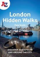 Wandelgids London Hidden Walks | Collins
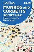 Wegenkaart - landkaart Pocket Map Munros and Corbetts | Collins
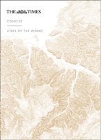 Atlas The Times Concise Atlas of the World | Collins
Het kleinere zusje van de grotere comprehensive atlas, maar nog steeds een imposante dikke verschijning! Gedetailleerde en prachtig uitgevoerde kaarten presenteren de perfecte combinatie van traditie, kennis en stijl. De …
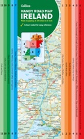
 Wegenkaart - landkaart Pocket Map Ireland pocket map - Ierland | Collins
Kleine handzame kaart van Ierland. Explore Ireland with this handy, full colour map. Handy little full colour map of Ireland at an excellent price. It is double-sided, with the …
★★★★★ Woordenboek Visual Dictionary Vietnamese - Vietnamees taalgids | Collins
Super handig! Een taalgids waarbij naast de gewone vertaling en een fonetische poging daartoe ook een plaatje staat weergegeven. Ideaal voor een moeizame conversatie in een taal die je echt …
 Wegenkaart - landkaart Map of Ireland Handy | Collins
Explore new places with this comprehensive map of Ireland from Collins. An easy-to-use route-planning map covering the whole of Ireland. It has the convenience of an atlas with all the …
 Wegenatlas Essential Road Atlas Britain 2025 | A4 | Ringband | Collins
This A4 road atlas with lie-flat spiral binding provides clear and detailed road mapping for England, Wales and Southern Scotland at a scale of 3.2 miles to 1 inch (1:200,000). …
 Stadsplattegrond Pocket Map Edinburgh | Collins
Handy little full colour map of central Edinburgh with a high level of detail. Clear mapping from Leith in the north to The Meadows in the south, and Edinburgh Zoo …
★★★★★ Wereldkaart Explorer's Map | 67 x 99 cm | Collins
 Atlas The Times Mini Atlas of the World | Collins
De kleinste uitvoering van de beste atlas ter wereld! Ook deze mini uitvoering is mooi van kleur en uiterlijk: een leuke kado voor een schappelijke prijs. A pocket-sized Times Atlas …
 Wegenkaart - landkaart Pocket Map Dumfries & Galloway | Collins
Handy little full colour map of Dumfries & Galloway. Main features of this map include: • Clear mapping • Main tourist attractions located and described • Ideal for touring …
 Wegenatlas Handy Road Atlas Ireland - Ierland | Collins
Handzame wegenatlas op A5 formaat van Ierland. Vrij grove schaal maar heel handig door formaat en goed kaartbeeld. Met enkele stadsplattegronden en een paar pagina's met hoogtepunten van het land. …
 Wandelkaart Route 66 | Collins
Full color, informative map of the famous US Route 66. With detailed mapping, key tourist information and a suggested itinerary, this is a perfect guide for anyone traveling along America’s …
 Wandelgids Park Rangers Favourite Walks Peak District | Collins
The perfect companions for exploring the National Parks. Walking guide to the Peak District National Park, with 20 best routes chosen by the park rangers. Each walk varies in length …
★★★★★ Woordenboek Visual Dictionary Thai taalgids | Collins
Super handig! Een taalgids waarbij naast de gewone vertaling en een fonetische poging daartoe ook een plaatje staat weergegeven. Ideaal voor een moeizame conversatie in een taal die je echt …
 Wegenkaart - landkaart Pocket Map Northern Ireland | Collins
Handy little full colour map of Northern Ireland. Main features of this map include: • Clear mapping • Main tourist attractions located and described • Ideal for touring with …
 Stadsplattegrond Pocket Map Glasgow | Collins
Clear, detailed, full color Collins mapping is presented in a handy format ideal for the pocket or handbag. It is excellent value and covers the most visited area of central …
 Wegenkaart - landkaart Pocket Map Orkney | Collins
Handy little full colour map of the Orkney Islands in Scotland. Detailed mapping and tourist information for Orkney mainland, Westray, Sanday, Stronsay, Shapinsay, Hoy, South Ronaldsay and the other islands. …
★★★★★ Wegenkaart - landkaart National Park Pocket Map New Forest | Collins
Handige kleine kaart van dit Nationaal Park. De kaart geeft een goed en helder overzicht van het gebied met alle plaatsen, doorgaande wandelpaden (alhoewel grof van schaal), bezienswaardigheden etc. Met …
 Wegenkaart - landkaart Pocket Map Pennines | Collins
Handy little full colour map of the Pennines. Main features of this map include: • Clear mapping • Main tourist attractions located and described • Ideal for touring with …
Laatste reviews

We hebben zowel noord als zuid Corsica gekocht. We hebben ze voor onze vakantie in juni nodig en hebben graag een gedetailleerde kaart om te …
★★★★★ door Ruth 12 april 2025 | Heeft dit artikel gekocht
Fijne kaart vooral ter voorbereiding van onze vakantie op Corsica.
★★★★★ door Ruth 12 april 2025 | Heeft dit artikel gekocht
Met behulp van deze gids hebben we onze fietsreis uitgestippeld. Over ruim een maand gaan we richting Donau en zullen we deze gids zeker nog …
★★★★★ door Jan J. 11 april 2025 | Heeft dit artikel gekocht
Goed
★★★★★ door Schultz 11 april 2025 | Heeft dit artikel gekocht