Wandelatlas Adventure Atlas Cotswold Way | A-Z Map Company (9780008727758)
- ISBN / CODE: 9780008727758
- Editie: 27-03-2025
- Druk: 3
- Aantal blz.: 56
- Auteur(s): A-Z Maps
- Uitgever: A-Z Map Company
- Soort: Wandelatlas
- Serie: Adventure Atlas
- Taal: Engels
- Hoogte: 24.0 cm
- Breedte: 13.6 cm
- Dikte: 0.7 cm
- Gewicht: 96.0 g
- Bindwijze: Paperback
- Uitvoering: Papier
- Schrijf als eerste een review
-
€ 17,95
Leverbaar in 3 - 5 werkdagen in huis in Nederland Levertijd Belgie
Gratis verzending in Nederland vanaf €35,-
Beschrijving
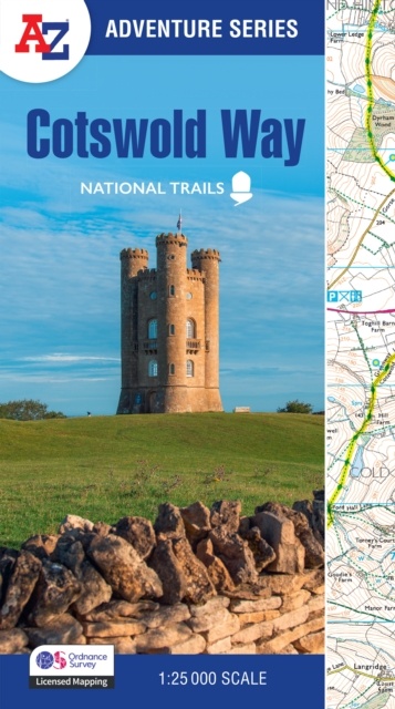
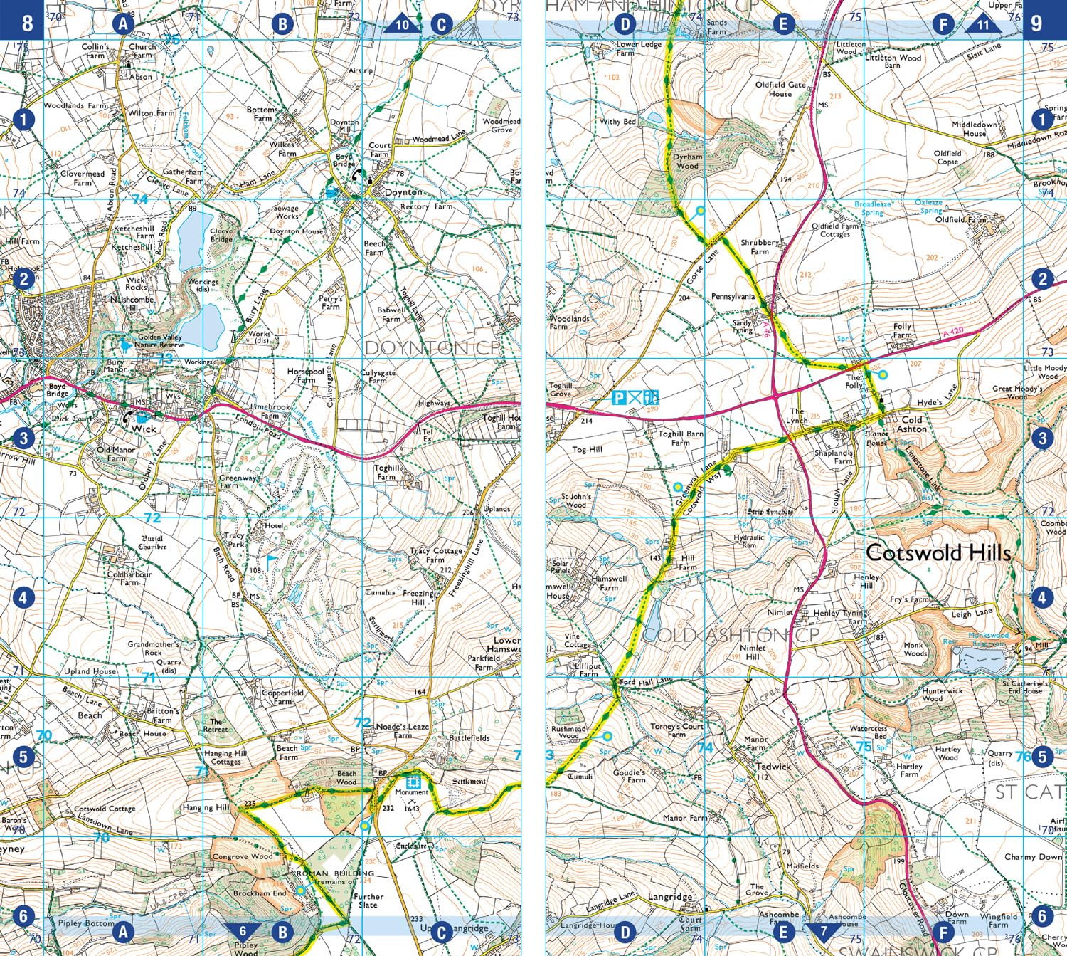
The A-Z Adventure Series uses Ordnance Survey mapping and is the perfect companion for walkers, off-road cyclists, and anyone wishing to explore the great outdoors.
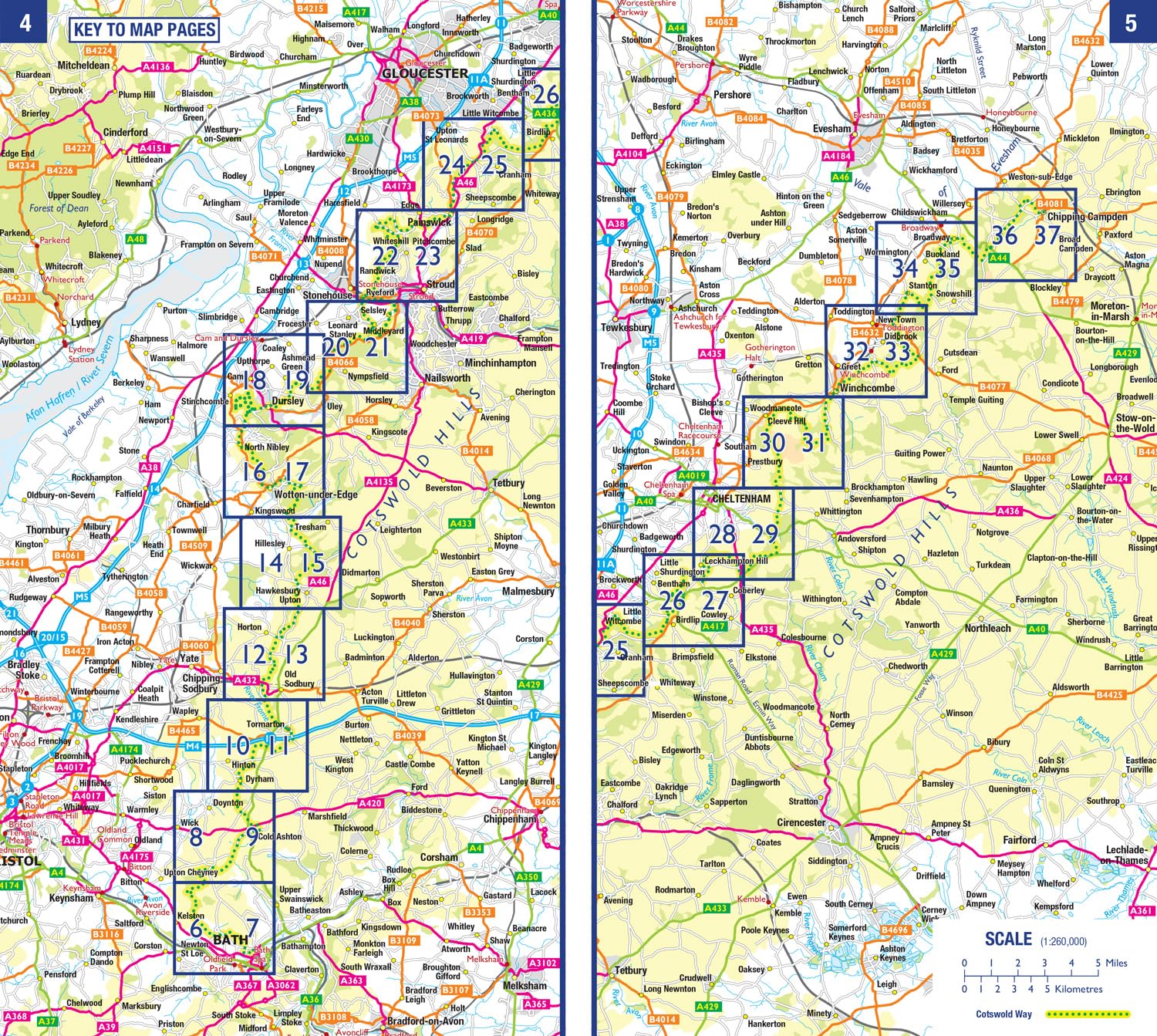
The Cotswold Way is a 102 mile (164 km) National Trail running along the Cotswold Hills. Starting in the historic City of Bath and finishing in Chipping Campden, the clearly marked route passes through numerous places of interest and an abundance of wildlife.
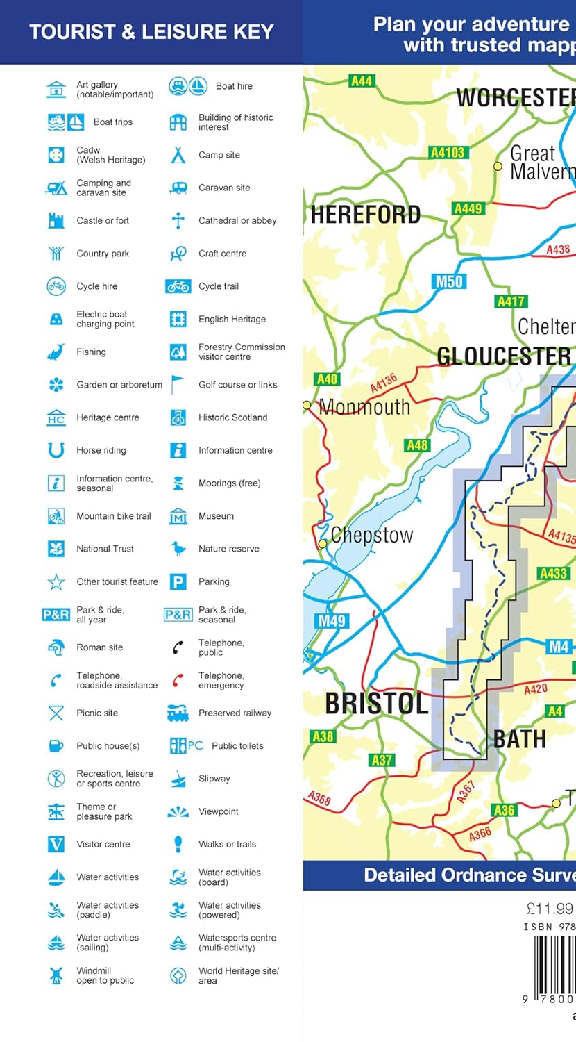
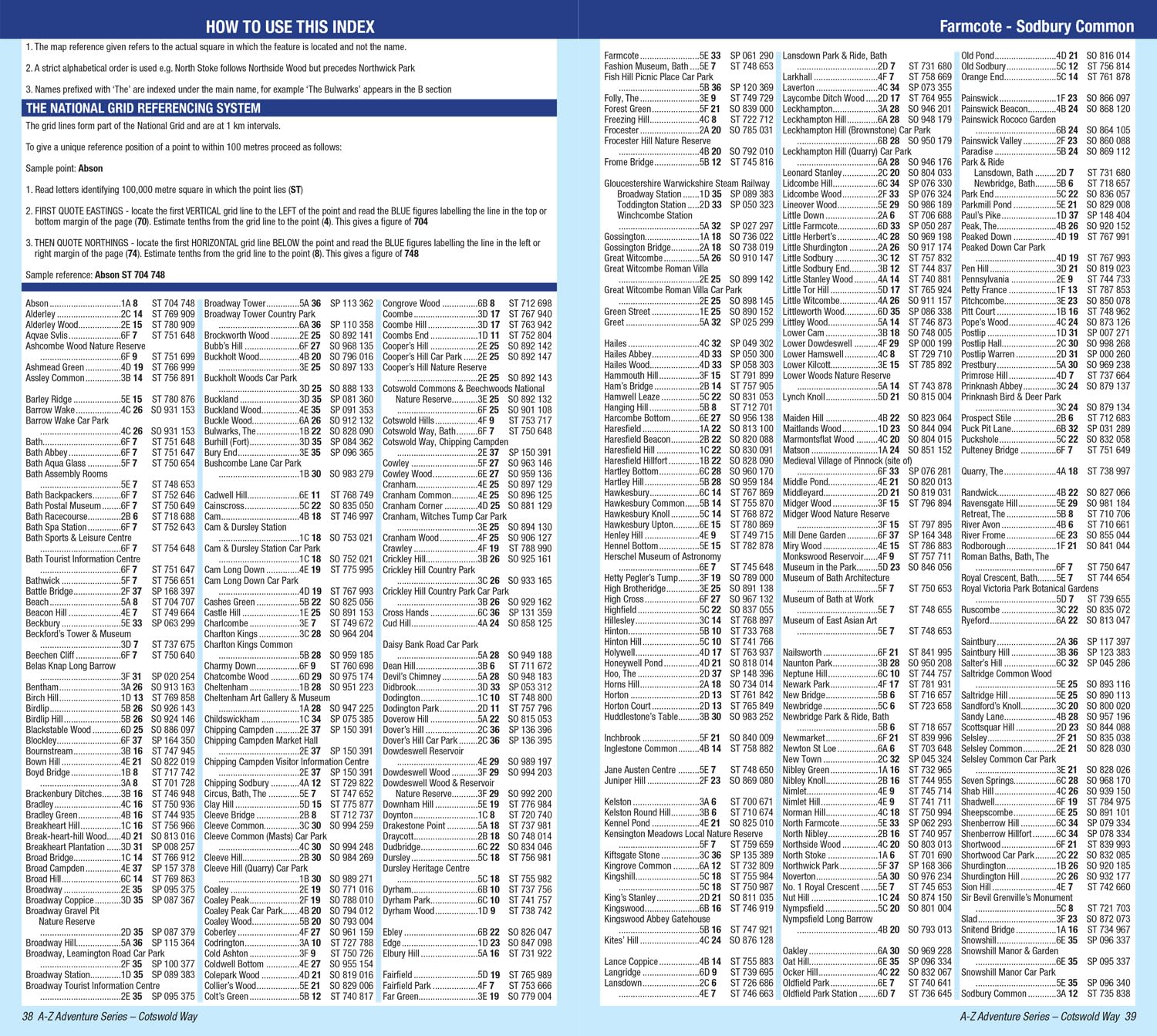
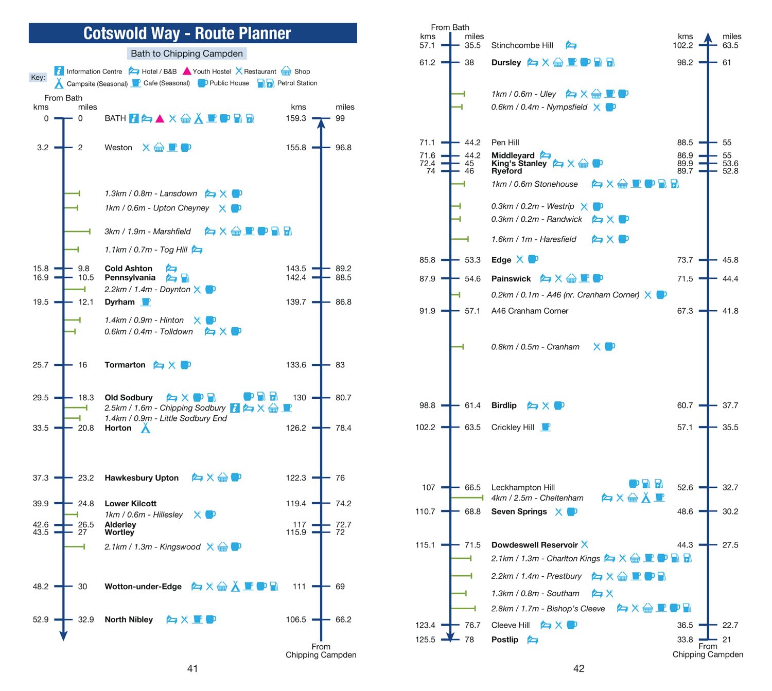
This official National Trail Map features detailed Ordnance Survey mapping at a scale of 1:25 000, providing complete coverage of the Cotswold Way. There is also a route planner included to show distances between places and the amenities available making it easy to plan your adventure. Additional features include:
- Information Centres
- Hotels/B&Bs
- Youth Hostels
- Campsites (seasonal opening)
- Public Houses
- Restaurants
- Shops
- Cafes (seasonal opening)
- Petrol Stations
Other books available in the A-Z Adventure series include: Peak District (Dark Peak), Peddars Way and Norfolk Coast Path, South Downs Way, Pembrokeshire Coast Path, South West Coast Path and The North Coast 500.
Reviews
Geen reviews gevonden voor dit product.
Schrijf een review
Graag horen wij wat u van dit artikel vindt. Vindt u het goed, leuk, mooi, slecht, lelijk, onbruikbaar of erg handig: schrijf gerust alles op! Het is niet alleen leuk om te doen maar u informeert andere klanten er ook nog mee!
Ook interessant voor europa/engeland/cotswolds
-

Wegenkaart - landkaart Cotswolds map
€ 15,95Wegenkaarten ♦ Cotswolds AONB -

Wandelgids Cotswolds | Ordnance Surv
€ 12,95Wandelgidsen South West England -

Wandelatlas Adventure Atlas Cotswold
€ 17,95Wandelatlassen ♦ Cotswolds AONB -

Reisgids The Cotswolds | Rough Guide
€ 22,50Reisgidsen ♦ Cotswolds AONB -

Wandelkaart - Topografische kaart OL
€ 19,50Topografische kaarten South West England