Winkelwagen
Geen items in winkelwagen
Ga naar winkelwagen
Kaarten - Dordogne (departement)
 Wandelkaart - Topografische kaart 1832 SB - Serie Bleue Montbron, Piégut-Pluviers | IGN - Institut Géographique National★★★★★
 Wandelkaart - Topografische kaart 1932 SB - Serie Bleue Châlus - St-Mathieu | IGN - Institut Géographique National
 Wandelkaart - Topografische kaart 1833 SB - Serie Bleue Nontron, Brantôme, Mareuil | IGN - Institut Géographique National
 Wandelkaart - Topografische kaart 1933 SB - Serie Bleue Thiviers, St-Pardoux-la-Rivière | IGN - Institut Géographique National
 Wandelkaart - Topografische kaart 1834 SB - Serie Bleue Périgueux , Tocane-Saint-Apre | IGN - Institut Géographique National
 Wandelkaart - Topografische kaart 1934 SB - Serie Bleue Excideuil - Périgueux | IGN - Institut Géographique National
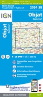 Wandelkaart - Topografische kaart 2034 SB - Serie Bleue Objat - Hautefort | IGN - Institut Géographique National★★★★★
 Wandelkaart - Topografische kaart 1735 SB - Serie Bleue Montpon-Ménestérol ,Saint-Médard-de-Mussidan | IGN - Institut Géographique National
 Wandelkaart - Topografische kaart 1835 SB - Serie Bleue Villamblard, Saint-Astier, Mussidan | IGN - Institut Géographique National
 Wandelkaart - Topografische kaart 1935 SB - Serie Bleue Vergt | IGN - Institut Géographique National
 Wandelkaart - Topografische kaart 2035 SB - Serie Bleue Terrasson-Lavilledieu, Montignac, Grotte de Lascaux | IGN - Institut Géographique National★★★★★
 Wandelkaart - Topografische kaart 1736 SB - Serie Bleue Ste-Foy-la-Grande, Vélines | IGN - Institut Géographique National
 Wandelkaart - Topografische kaart 1836 SB - Serie Bleue Creysse - Bergerac | IGN - Institut Géographique National
 Wandelkaart - Topografische kaart 1837 SB - Serie Bleue Eymet - Castillonnès | IGN - Institut Géographique National
 Wandelkaart - Topografische kaart 2038 SB - Serie Bleue Puy l'Evêque, Luzech | IGN - Institut Géographique National
 Wandelkaart - Topografische kaart 1936ET Les Eyzies, St.-Cyprien, le Bugue, Beynac | IGN - Institut Géographique National★★★★★
 Wandelkaart - Topografische kaart 2036ET Sarlat-la-Caneda, Souillac | IGN - Institut Géographique National★★★★★
 Wandelkaart - Topografische kaart 2136ET Rocamadour, Martel, Gouffre de Padirac, Gramat | IGN - Institut Géographique National★★★★★
 Wandelkaart - Topografische kaart 2033 SB - Serie Bleue Saint-Yrieix-La Perche-Lubersac | IGN - Institut Géographique National
 Wandelkaart - Topografische kaart 1734 SB - Serie Bleue Ribérac - Chalais | IGN - Institut Géographique National
Laatste reviews

fijne wandelkaart
Fijne wandelkaart. Schaal 1:40.000 Scheur, kreuk, slijt en rol vast. Waterdicht. Uitstekende kaart voor onderweg. Je kunt hem overal tussen of in proppen. (bijna) niet …
★★★★★ door Pieter Bosse 26 april 2025 | Heeft dit artikel gekocht
fijne kaart
had al een oudere versie van deze kaart, maar deze heeft zeker een update gehad
★★★★★ door P v Spronsen 24 april 2025 | Heeft dit artikel gekocht
Fijne en overzichtelijke kaart
Zoals van Michelin te verwachten, een goed leesbare overzichtskaart met nog best wel aardig wat details. Fijn dat het zuiden van Canada er ook net …
★★★★★ door Gert Stolk 24 april 2025 | Heeft dit artikel gekocht
Handige gids met vele bruikbare tips
Ter voorbereiding op onze trip naar Chalkidiki heb ik al de nodige tips en suggesties genoteerd. Daarnaast heb ik ook m'n Duits weer kunnen ophalen...
★★★★★ door HFJ Driessen 23 april 2025 | Heeft dit artikel gekocht