Winkelwagen
Geen items in winkelwagen
Ga naar winkelwagen
Kaarten - Haute-Loire
 Wegenkaart - landkaart 331 Ardeche - Haute Loire | Michelin★★★★★
 Wandelkaart - Topografische kaart 2836OT Gerbier de Jonc | IGN - Institut Géographique National
 Wandelkaart - Topografische kaart 2935OT Le Chambon-sur-Lignon - St-Agrève Ardéche | IGN - Institut Géographique National
 Wandelkaart - Topografische kaart 2835OT Le Puy-en-Velay | IGN - Institut Géographique National
 Wandelkaart - Topografische kaart 2633 SB - Serie Bleue St-Germain-l'Herm, Brassac-les-Mines | IGN - Institut Géographique National
 Wandelkaart - Topografische kaart 2534 SB - Serie Bleue Massiac - Ardes | IGN - Institut Géographique National
 Wandelkaart - Topografische kaart 2634 SB - Serie Bleue Paulhaguet - Brioude | IGN - Institut Géographique National
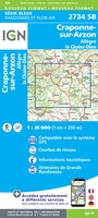 Wandelkaart - Topografische kaart 2734 SB - Serie Bleue Allègre, La Chaise-Dieu, Craponne-sur-Arzon | IGN - Institut Géographique National
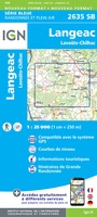 Wandelkaart - Topografische kaart 2635 SB - Serie Bleue Langeac - Lavoûte-Chilhac | IGN - Institut Géographique National
 Wandelkaart - Topografische kaart 2636 SB - Serie Bleue Saugues | IGN - Institut Géographique National
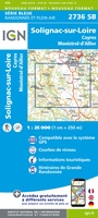 Wandelkaart - Topografische kaart 2736 SB - Serie Bleue Monistrol d'Allier, Solignac-sur-Loire, Cayres | IGN - Institut Géographique National
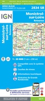 Wandelkaart - Topografische kaart 2834 SB - Serie Bleue Monistrol-sur-Loire, Retournac | IGN - Institut Géographique National
 Wandelkaart - Topografische kaart 2735 SB - Serie Bleue Loudes, Le Puy-en-Velay | IGN - Institut Géographique National
 Wandelkaart 89023 GR 70 The Stevenson Trail | IGN - Institut Géographique National★★★★★
 Wandelkaart - Pelgrimsroute (kaart) 89020 St-Jacques-de-Compostela GR 65-1, St Jacobsroute | IGN - Institut Géographique National
 Wegenkaart - landkaart - Fietskaart D43 Top D100 Haute - Loire | IGN - Institut Géographique National
 Wegenkaart - landkaart D42-43 Loire - Haute-Loire | IGN - Institut Géographique National
 Wandelkaart 2835OT Le Puy-en-Velay / Yssingeaux | IGN - Institut Géographique National
 Wegenkaart - landkaart 14 TOP 250 Auvergne - Rhône-Alpes - Massif Central | IGN - Institut Géographique National
 Wegenkaart - landkaart 15 TOP 250 Auvergne - Rhône-Alpes - Massif Alpin | IGN - Institut Géographique National
Laatste reviews

Handig formaat maar mis overzichtskaart
Super om dit boekje via jullie te kunnen bestellen, zodat je de wegenatlas direct na aankomst kunt gebruiken.
★★★★★ door B van Leeuwen 22 april 2025 | Heeft dit artikel gekocht
Hele gedetailleerde kaartenatlas
Lekker ouderwets met het kaartenboek op schoot op vakantie. Hier staan echt nog de kleinste weggetjes in. Ideaal. Dan weet ik tenminste waar ik me …
★★★★★ door Marja Blom 22 april 2025 | Heeft dit artikel gekocht
zeer goed
Zeer goede, duidelijke kaart. Met kaart en kompas wandeling gedaan in Natuurgebied rond Montherme.
★★★★★ door De Schryver Sven 21 april 2025 | Heeft dit artikel gekocht
zeer goed
Zeer goede, duidelijke kaart. Met kaart en kompas wandeling gedaan in Natuurgebied rond Montherme.
★★★★★ door De Schryver Sven 21 april 2025 | Heeft dit artikel gekocht