Winkelwagen
Geen items in winkelwagen
Ga naar winkelwagen
Kaarten - Saône-et-Loire
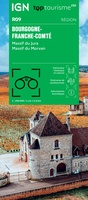 Wegenkaart - landkaart 09 TOP 250 Bourgogne - Franche-Comté | IGN - Institut Géographique National
 Wandelkaart 3025 SB - Serie Bleue Chalon-sur-Saône (Nord) - Chagny | IGN - Institut Géographique National1
 Wandelkaart - Topografische kaart 3026 SB - Serie Bleue Chalon-sur-Saône, St-Gernain-du-Plain | IGN - Institut Géographique National
 Wandelkaart - Topografische kaart 3027 SB - Serie Bleue Tournus - Lugny | IGN - Institut Géographique National
 Wandelkaart - Topografische kaart 3028OT Mâcon - Cluny | IGN - Institut Géographique National
 Wandelkaart - Topografische kaart 2824OT Autun - Mont Beuvray | IGN - Institut Géographique National★★★★★
 Wandelkaart - Topografische kaart 2826 SB - Serie Bleue Luzy, Toulon-sur-Arroux | IGN - Institut Géographique National
 Wandelkaart - Topografische kaart 2827 SB - Serie Bleue Paray-le-Monial | IGN - Institut Géographique National
 Wandelkaart - Topografische kaart 2828 SB - Serie Bleue Charolles | IGN - Institut Géographique National★★★★★
 Wandelkaart - Topografische kaart 2829 SB - Serie Bleue Charlieu – Chauffailles | IGN - Institut Géographique National
 Wandelkaart - Topografische kaart 2924 SB - Serie Bleue Arnay-le-Duc – Epignac | IGN - Institut Géographique National★★★★★
 Wandelkaart - Topografische kaart 2925 SB - Serie Bleue Autun - Le Creusot | IGN - Institut Géographique National
 Wandelkaart - Topografische kaart 2926 SB - Serie Bleue Montceau-les-Mines, Ecuisses | IGN - Institut Géographique National
 Wandelkaart - Topografische kaart 2927 SB - Serie Bleue St-Bonnet-de-Joux – Saint-Gengoux-le-National | IGN - Institut Géographique National
 Wandelkaart - Topografische kaart 2928 SB - Serie Bleue Cluny Matour | IGN - Institut Géographique National
 Wandelkaart - Topografische kaart 3125 SB - Serie Bleue Pierre-de-Bresse, St-Martin-de-Bresse | IGN - Institut Géographique National
 Wandelkaart - Topografische kaart 3126 SB - Serie Bleue Mervans, Montret. Louhans | IGN - Institut Géographique National
 Wandelkaart - Topografische kaart 3127 SB - Serie Bleue Cuiseaux | IGN - Institut Géographique National
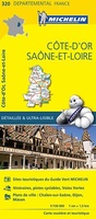 Wegenkaart - landkaart 320 Cote d'Or - Saone et Loire | Michelin★★★★★
 Topografische kaart - Wandelkaart 3226ET Lons-le-Saunier / Poligny / Reculée de Baume | IGN - Institut Géographique National
Laatste reviews

Goede kaart van Griekenland
Handige indeling van kaart in twee delen. Prettige structuur en kleurgebruik op kaart Veel informatie over wegen en bijzienswaardigheden Jammer dat bijbehorende informatie alleen digitaal …
★★★★★ door J. Wolf 19 december 2025 | Heeft dit artikel gekocht
Interessante puzzel
De puzzel heeft niet de karakteristiek gevormde puzzelstukjes, maar computer gegenereerde stukjes. Dat makt het leggen van de puzzel een nieuwe en interessante ervaring. Het …
★★★★★ door Wim Scheenen 15 december 2025 | Heeft dit artikel gekocht
Dit is een succesnummer.
Het was een beetje een gok, maar mijn 4 jarige kleinzoon is een puzzel fanaat. Het verbaasde mij hoe zelfstandig hij de puzzel kan maken. …
★★★★★ door Gerard Lijnzaad 15 december 2025 | Heeft dit artikel gekocht
Prima levering
Prima levering. Prima kaart.
★★★★★ door Felix 11 december 2025 | Heeft dit artikel gekocht