Wandelgidsen - Yorkshire and the Humber
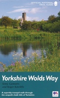 Wandelgids Yorkshire Wolds Way | Aurum Press
Een mooie wandelgids met een goede beschrijving en hele duidelijke kaarten met ingetekende route. The Yorkshire Wolds were brought to international attention in 2012 by David Hockney’s magnificent Royal …
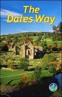
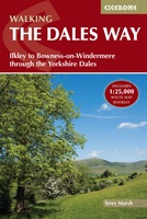 Wandelgids The Dales Way | Cicerone
A fully waymarked trail from Ilkley to Bowness-on-Windermere, the Dales Way links two of England's most celebrated national parks, the Yorkshire Dales and the Lake District. Well served for accommodation …
★★★★★ Wandelgids Hadrian's Wall Path | Aurum Press
Beschrijving van Hadrian's Wall Path. Historische en culturele aspecten komen vrij uitgebreid aan bod, praktische informatie is wel summier. Kaartmateriaal van Ordnance Survey is zonder meer uitstekend! Since it opened …
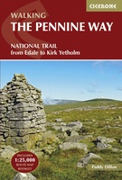 Wandelgids The Pennine Way | Cicerone
Uitstekende wandelgids van de Pennine Way, waarbij naast alle noodzakelijke informatie ook gebruik gemaakt wordt van de echte topografische kaart. inclusief gidsje met routekaarten van 1:25000 Guidebook to the Pennine …
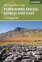 Wandelgids The Yorkshire Dales - Walking in the North and East | Cicerone
This guidebook contains 43 circular day walks in the north and east Yorkshire Dales. It explores the dales, hills and moors between Kirkby Stephen and Pateley Bridge. Walking ranges from …
 Wandelgids The Dales Way | Rucksack Readers
This charming walk runs for 79 miles (127 km) from Ilkley in the Yorkshire Dales to Bowness in the Lake District. The route heads north through Wharfedale, crisscrossing the river, …
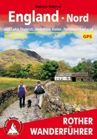 Wandelgids England Nord - Engeland Noord | Rother Bergverlag
Uitstekende wandelgids met 60 dagtochten. Met praktische informatie en beperkt kaartmateriaal! Wandelingen in verschillende zwaarte weergegeven in rood/blauw/zwart. Deze wandelgidsen uitgever staat hoog aangeschreven en is een begrip onder de …
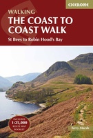 Wandelgids Coast to Coast Walk, From St Bees to Robin Hood's Bay | Cicerone
De beschrijving van de klassieke kust naar kust wandeling in het noorden van Engeland. Een van de mooiste en meest afwisselende wandeltochten van heel Engeland. Inclusief gidsje met routekaarten van …
★★★★★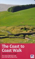 Wandelgids Coast to Coast Walk - van Ierse Zee tot Noordzee | Aurum Press
Goede gids over dit inmiddels beroemde pad. Kaartmateriaal is perfect, alsmede achtergrondinformatie. Praktische info wat minder, maar die is op de ramblerssite op internet te vinden! The Coast to Coast …
 Wandelgids The Cleveland way and the Yorkshire Wolds way | Cicerone
Uitstekende wandelgids van de Cotswolds Way, waarbij naast alle noodzakelijke informatie ook gebruik gemaakt wordt van de echte topografische kaart. Inclusief gidsje met routekaarten van 1:25000 Guidebook to the Cleveland …
 Wandelgids Coast to Coast the Wainwright Route | Rucksack Readers
Lange afstandswandelgids van de Coast to Coast wandeling. Wandelgids met kaarten en beschrijving. op waterbestendig papier, in spiraalbinding. This challenging walk of 184 miles (296 km) crosses the north of …
 Wandelgids 049 Pathfinder Guides Vale of York and the Yorkshire Wolds | Ordnance Survey
Wandelgids van een deel van Engeland. Deze gids bevat 28 dagwandelingen, variërend van korte tochten tot pittige dagtochten. De bijbehorende kaarten zijn uitstekend: men heeft de topografische kaarten van Ordnance …
 Wandelgids Walking in the Yorkshire Dales: South and West | Cicerone
Veelzijdige wandelgids van een deel van de Yorkshire Dales, goede kaarten en beschrijvingen en veel keuze uit een behoorlijk aantal wandelingen. Part of a two-book set, this guidebook describes 44 …
 Wandelgids The North York Moors | Cicerone
Uitstekende wandelgids van dit geweldige gebied. Goed beschreven met veel praktische informatie om de routes te kunnen lopen, inclusief redelijke kaarten. Guidebook to 50 walks in the North York Moors …
 Wandelgids 028 Pathfinder Guides North York Moors | Ordnance Survey
Get lost in 28 beautiful walks exploring the North York Moors with the OS Pathfinder Guidebooks, graded by length and ranging from 3.5 to 11 miles. Make the most …
★★★★★ Wandelgids Park Rangers Favourite Walks Yorkshire Dales | Collins
Compacte wandelgids met 20 wandelingen geselecteerd door park rangers en met duidelijke beschrijvingen en routekaartjes. Walking guide to the Yorkshire Dales National Park, with 20 best routes chosen by …
 Wandelgids 063 Pathfinder Guides Peak District | Ordnance Survey
Wandelgids van een deel van Engeland, Schotland of Wales. Deze gids bevat 28 dagwandelingen, variërend van korte tochten tot pittige dagtochten. De bijbehorende kaarten zijn uitstekend: men heeft de topografische …
 Wandelgids Coast to Coast Path: St Bees to Robin Hood's Bay | Trailblazer Guides
Goede wandelgids van de hele route van kust naar kust. Met veel details zijn alle etappes beschreven. Tevens informatie over overnachtingen en openbaar vervoer. All the information you need to …
★★★★★ Wandelgids 15 Short Walks Short Walks in Nidderdale | Cicerone
Jon Fallis has chosen 15 of the best short walks around Nidderdale in the Yorkshire Dales for you to explore. Our guide comes with easy-to-read Ordnance Survey maps and clear …
 Wandelgids Wainwright's Coast to Coast Walk | Frances Lincoln
This is the first fully revised and updated edition of A. Wainwright's pocket-sized guide to the Coast to Coast Walk which he devised in the early 1970s. Over the years, …
Laatste reviews

De artikelen lijken prima items voor mijn reis. Deze moet nog plaatsvinden dus ik kan nog niet zeggen hoe ze bevallen. Bij de voorpret hebben …
★★★★★ door Adrianne 08 april 2025 | Heeft dit artikel gekocht
De artikelen lijken prima items voor mijn reis. Deze moet nog plaatsvinden dus ik kan nog niet zeggen hoe ze bevallen. Bij de voorpret hebben …
★★★★★ door Adrianne 08 april 2025 | Heeft dit artikel gekocht
Een review is overbodig.
★★★★★ door Hans 07 april 2025 | Heeft dit artikel gekocht
Erg fijn om deze goede reisgids bij de Zwerver te kunnen kopen, en ook de bijbehorende landkaart! Goede kwaliteit en breed assortiment.
★★★★★ door lotje 07 april 2025 | Heeft dit artikel gekocht