dublin : 73 resultaten gevonden
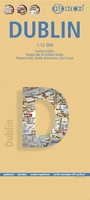 Stadsplattegrond Dublin | Borch
Borch Dublin is een duidelijke, geplastificeerde plattegrond van het centrum met informatie over openbaar vervoer en bezienswaardigheden. Inclusief straatnamenregister. Our soft-laminated folded map of Dublin shows: Central Dublin 1:12 000, …
★★★★★ Reisverhaal Dublin, stad vol verhalen | Cathelijne de Wit-Peijs
Dublin, stad vol verhalen is als een reisleider die in je tas past. Deze gids heb je nodig tijdens je bezoek aan Dublin, want de Ierse hoofdstad zit vol verhalen …
 Wandelgids Dublin & Wicklow | The Collins Press
Duidelijke wandelgids van dit specifieke deel van Ierland. Goede praktische informatie en zeker voor de GPS wandelaar handig met vermelde waypoints. Kaarten zijn schetsmatig, maar er wordt verwezen naar de …
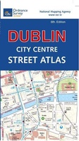 Wegenatlas Discovery Dublin city center atlas pocket | Ordnance Survey Ireland
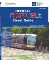 Wegenatlas Dublin official city & district street guide spiral | Ordnance Survey Ireland
Navigate your way around Dublin with confidence with the Official Dublin City & District Street Guide. Find your way around Ireland’s vibrant, historic capital with an enlarged city centre map …
 Reisgids City Guide Dublin | Lonely Planet
De perfecte reisgids voor zowel de georganiseerde als de zelfstandige reiziger. Naast een algemene inleiding van de stad vol met praktische informatie over hoe je er het beste kunt reizen: …
★★★★★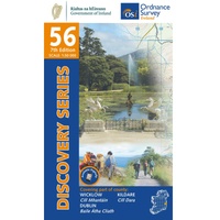 Topografische kaart - Wandelkaart 56 Discovery Wicklow, Dublin, Kildare | Ordnance Survey Ireland
Zeer gedetailleerde topografische kaart met een aantal toegevoegde toeristische symbolen voor bijv. Bezienswaardigheden en campings. Met hoogtelijnen, mooi kleurgebruik en ingetekende lange-afstands-wandelroutes.
★★★★★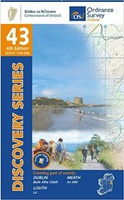 Topografische kaart - Wandelkaart 43 Discovery Dublin, Louth, Meath | Ordnance Survey Ireland
Zeer gedetailleerde topografische kaart met een aantal toegevoegde toeristische symbolen voor bijv. bezienswaardigheden, campings en jeugdherbergen. Met hoogtelijnen, mooi kleurgebruik en ingetekende lange-afstands-wandelroutes. Op deze kaart zijn de nationale parken …
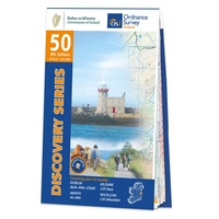 Topografische kaart - Wandelkaart 50 Discovery Dublin, Kildare, Meath, Wicklow | Ordnance Survey Ireland
Zeer gedetailleerde topografische kaart met een aantal toegevoegde toeristische symbolen voor bijv. bezienswaardigheden, campings en jeugdherbergen. Met hoogtelijnen, mooi kleurgebruik en ingetekende lange-afstands-wandelroutes. Op deze kaart zijn de nationale parken …
★★★★★ Wegenatlas Road Atlas Ireland - Ierland | AA Publishing
Handige wegenatlas van Ierland en Noord-Ierland, schaal 1:200.000. Met 10 stadsplattegronden: Belfast, Cork, Londonderry, Dublin, Galway, Killarney, Kilkenny, Limerick, Sligo and Waterford. Created from brand new mapping data, this atlas …
★★★★★ Wegenkaart - landkaart Ierland | ITMB
As technology improves, we are able to produce more detailed maps than was previously possible. Such is the case with Ireland, a part of the world consisting of two countries …
 Fietsgids Cycling South Dublin & Wicklow | The Collins Press
From the doorstep of Dublin city, there is easy access to a different world of deep glens, forested mountains and wild scenery, including the Wicklow Mountains, the largest continuous upland …
 Stadsplattegrond City map Dublin | Lonely Planet
Durable and waterproof, with a handy slipcase and an easy-fold format, Lonely Planet's Dublin City Map is your conveniently sized passport to travelling with ease. With this easy-to-use, full-colour navigation …
 Wegenkaart - landkaart Ireland - Ierland | AA Publishing
Folded, double-sided sheet map shows the detailed road network with toll motorways and dual carriageways identified. Includes motorway service areas, AA-inspected campsites, viewpoints and picnic sites. Gaeltacht regions are highlighted …
 Wegenkaart - landkaart Pocket Map Ireland pocket map - Ierland | Collins
Kleine handzame kaart van Ierland. Explore Ireland with this handy, full colour map. Handy little full colour map of Ireland at an excellent price. It is double-sided, with the …
★★★★★ Reisgids Ierland: De Ultieme Roadtrip | Daniël van de Velde
Cathelijne de Wit-Peijs woont in Ierland en werkt met haar bedrijf Witty Walks als gids in Dublin en de Wicklow Mountains. Tijdens haar tours krijgt zij regelmatig de vraag: “Wat …
 Reisgids Ireland - Ierland | Rough Guides
Een zeer uitvoerige reisgids voor zowel de zelfstandige als de georganiseerde reiziger. Veel informatie, zowel praktisch als over allerhande achtergronden van het land; met o.a. aandacht voor geschiedenis, taal, flora …
 Reisgids Ireland - Ierland | Insight Guides
Goede reisgids voor Ierland. Dé gids als het gaat om achtergrondinformatie en prachtige foto’s. Kwalitatief van een hoog niveau! Engelstalig. This Insight Guide is a lavishly illustrated inspirational travel guide …
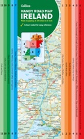 Wegenkaart - landkaart Map of Ireland Handy | Collins
Explore new places with this comprehensive map of Ireland from Collins. An easy-to-use route-planning map covering the whole of Ireland. It has the convenience of an atlas with all the …
 Reisgids Experience Ireland | Lonely Planet
Lonely Planet's Experience Ireland is your guide to unforgettable experiences and local surprises. - all guided by local experts with fresh perspectives. Drive the Wild Atlantic Way, sip stout in …
Laatste reviews

We hebben zowel noord als zuid Corsica gekocht. We hebben ze voor onze vakantie in juni nodig en hebben graag een gedetailleerde kaart om te …
★★★★★ door Ruth 12 april 2025 | Heeft dit artikel gekocht
Fijne kaart vooral ter voorbereiding van onze vakantie op Corsica.
★★★★★ door Ruth 12 april 2025 | Heeft dit artikel gekocht
Met behulp van deze gids hebben we onze fietsreis uitgestippeld. Over ruim een maand gaan we richting Donau en zullen we deze gids zeker nog …
★★★★★ door Jan J. 11 april 2025 | Heeft dit artikel gekocht
Goed
★★★★★ door Schultz 11 april 2025 | Heeft dit artikel gekocht