Wandkaarten - Europa
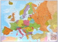
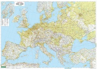
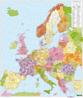 Wandkaart Europa met postcodes | 114 x 97 cm | Freytag & Berndt
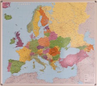 Prikbord Europa politiek prikbord | IGN - Institut Géographique National1
 Magneetbord Europa politiek magneetbord | IGN - Institut Géographique National1
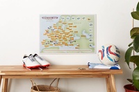 Scratch Map European Football Grounds travel Collect & Scratch | Maps International
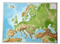
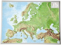 Reliëfkaart Europa met voelbaar 3D reliëf | A3 | 42 x 30 cm | GeoRelief
De uitgever van de kaart is de bekende Duitse uitgever GeoRelief GbR. Deze topografische kaart van Europa heeft een hoge kwaliteit met prachtige kleuren (engelse versie). De kaart bevat de …
 Wandkaart 58 Das Große Europa Panorama | MairDumont
Een prachtige wandkaart van Europa waarin in vogelvlucht-perspectief de natuurkundige aspecten van Europa mooi te zien zijn. Der Blick des Betrachters wandert von der gleißenden Helle der Nordpol-Kappe über hellgrüne …
★★★★★★★★★★ Wandkaart Europa - Europe Huge, 170 x 124 cm | Maps International
Fraaie politieke kaart van Europa, waarbij vooral de politieke aspecten heel duidelijk te lezen zijn. Alle landen hebben verschillende kleuren, steden en belangrijke verbindingen zijn goed te vinden. Papieren uitvoering. …
★★★★★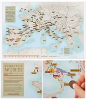 Scratch Map European Wines - Europese Wijnen Collect & Scratch | Maps International
Met deze kaart kan je de wijnproevers een plezier doen! Deze kaart maakt deel uit van de nieuwe reeks 'Collect and Scratch' en toont ruim 100 Europese wijnregio's, voorgesteld …
 Wandkaart - Reliëfkaart Europa met voelbaar 3D reliëf, 77 x 55 x 2 cm | GeoRelief
De uitgever van de kaart is de bekende Duitse uitgever GeoRelief GbR. Deze topografische kaart van Europa heeft een hoge kwaliteit met prachtige kleuren (engelse versie). De kaart bevat de namen …
★★★★★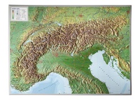 Wandkaart - Reliëfkaart van de Alpen met voelbaar 3D Reliëf, 77 x 57 cm | GeoRelief
De uitgever van de kaart is de bekende Duitse uitgever GeoRelief. Deze topografische kaart van de Alpen heeft een hoge kwaliteit met prachtige kleuren. De kaart bevat de namen van …
★★★★★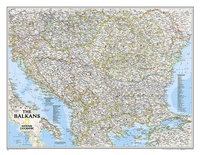 Wandkaart 20581 The Balkans - Balkan landen, 77 x 60 cm | National Geographic
Study the countries of the Balkans with our new map featuring the classic National Geographic reference styling. Features thousands of place names, accurate political boundaries, national parks, and major infrastructure …
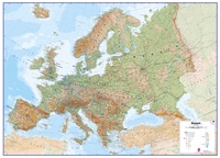 Wandkaart Europa Natuurkundig, 135 x 98 cm | Maps International
Maps International's large physical wall map of Europe is one of the finest money can buy. European Map details: Our large physical wall map of Europe features the natural …
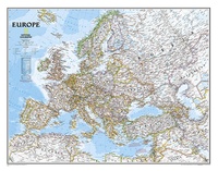 Wandkaart 20070 Europa, politiek, 77 x 60 cm | National Geographic
This colorful Europe political map clearly shows country boundaries, capitals, many major cities, bodies of water, airports, major highways and roads, and much more.
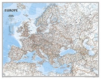 Wandkaart 20075 Europa, politiek, 114 x 88 cm | National Geographic
This colorful Europe political map clearly shows country boundaries, capitals, many major cities, bodies of water, airports, major highways and roads, and much more.
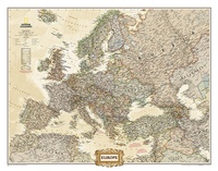 Wandkaart 20323 Europa, politiek & antiek, 77 x 60 cm | National Geographic
National Geographic is a renowned authority in cartography. For 120 years the Society's maps have helped spread geographic knowledge around the globe. A vast database allows National Geographic to combine …
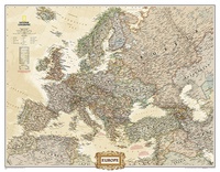 Wandkaart 20326 Europa, politiek & antiek, 116 x 90 cm | National Geographic
National Geographic is a renowned authority in cartography. For 120 years the Society's maps have helped spread geographic knowledge around the globe. A vast database allows National Geographic to combine …
 Wandkaart Europa, politiek & antiek, 249 x 194 cm | National Geographic
Deze kaart wordt gemaakt in drie delen - te groot om in 1 keer te fabriceren met kans op beschadigingen - die vervolgens zeer nauwkeurig aan elkaar worden geplakt. …
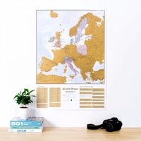 Scratch Map Europa Kraskaart | Maps International
This is a brilliant concept scratch poster of Europe allowing visited destinations to be scratched off revealing the beautifully styled up to date large wall map of Europe underneath. The …
★★★★★ Wandkaart Europa fysisch groot | 170 x 121 cm | Freytag & Berndt
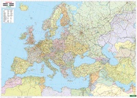 Wandkaart Europa / Midden-Oosten / Azie Centraal politiek | 127 x 90 cm | Freytag & Berndt
Laatste reviews

Een review is overbodig.
★★★★★ door Hans 07 april 2025 | Heeft dit artikel gekocht
Erg fijn om deze goede reisgids bij de Zwerver te kunnen kopen, en ook de bijbehorende landkaart! Goede kwaliteit en breed assortiment.
★★★★★ door lotje 07 april 2025 | Heeft dit artikel gekocht
Je kan met deze kaart prima wandelen op boerenlandweggetjes maar absoluut niet in de bergen. Veel wandelroutes staan niet op de kaart ingetekend. De wandelpaden …
★★★★★ door Mark Nikamp 04 april 2025 | Heeft dit artikel gekocht
We hebben het boekje kado gedaan. Maar eerst zelf in gekeken. Zal er mooi uit met verschillende soorten van routes. Zijn benieuwd naar de reaktie …
★★★★★ door Reukers 02 april 2025 | Heeft dit artikel gekocht