♦ Devon - Cornwall
 Wandelkaart - Topografische kaart 167 OS Explorer Map Thornbury, Dursley, Yate | Ordnance Survey
Met zijn 4cm voor 1 km (2 ½ cm voor 1 mijl) schaal, is de OS Explorer kaartenserie de ideale en meest gedetailleerde kaartenreeks voor mensen die graag outdoor-activiteiten zoals …
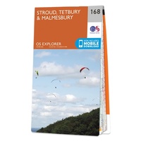 Wandelkaart - Topografische kaart 168 OS Explorer Map Stroud, Tetbury, Malmesbury | Ordnance Survey
Met zijn 4cm voor 1 km (2 ½ cm voor 1 mijl) schaal, is de OS Explorer kaartenserie de ideale en meest gedetailleerde kaartenreeks voor mensen die graag outdoor-activiteiten zoals …
★★★★★ Wandelkaart - Topografische kaart 169 OS Explorer Map Cirencester, Swindon | Ordnance Survey
Met zijn 4cm voor 1 km (2 ½ cm voor 1 mijl) schaal, is de OS Explorer kaartenserie de ideale en meest gedetailleerde kaartenreeks voor mensen die graag outdoor-activiteiten zoals …
 Reisgids Wild Swimming Torbay | Wild Things Publishing
In this lovingly-researched new guide, Matt Newbury and Sophie Pierce take the reader beyond the popular beaches into a hidden world. Torbay's 22 miles of coastline is enormously diverse, from …
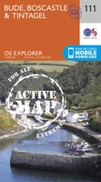 Wandelkaart - Topografische kaart 111 OS Explorer Map | Active Bude / Boscastle / Tintagel | Ordnance Survey
Met zijn 4cm voor 1 km (2 ½ cm voor 1 mijl) schaal, is de OS Explorer kaartenserie de ideale en meest gedetailleerde kaartenreeks voor mensen die graag outdoor-activiteiten zoals …
 Fietskaart 02 Cycle Maps UK North and South Devon | Cordee
Een nieuwe fietskaarten serie van Groot-Brittannië. Gedrukt op scheur- en watervast papier en mooi handzaam klein formaat. Deze kaarten zijn met name heel goed om de Lange Afstands Fietsroutes (LF) …
 Wandelgids Day Walks in Devon | Vertebrate Publishing
Day Walks in Devon features 20 circular routes, between 8.8 and 17.6 miles (14.1km and 28.3km), suitable for hillwalkers of all abilities. The routes are split into five geographical areas: …
 Wandelgids Day Walks in Cornwall | Vertebrate Publishing
Day Walks in Cornwall features 20 circular routes between 7.2 and 13.7 miles (11.6km and 22km) in length, suitable for hillwalkers of all abilities. Researched and written by experienced authors …
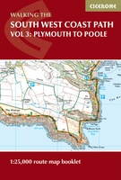 Wandelatlas South West Coast Path Map Booklet - Vol 3 | Cicerone
This booklet of Ordnance Survey 1:25,000 Explorer maps shows the full line of the section of the National Trail between Plymouth and Poole, providing all the mapping you need to …
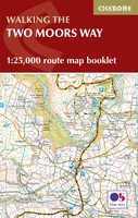 Wandelkaart Two Moors Way map Booklet | Cicerone
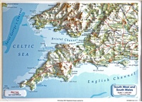 Reliëfkaart Engeland Zuidwest in gift box | 30 x 22 cm | Dorrigo
 Reisgids Marco Polo NL Zuid England | 62Damrak
Marco Polo reisgids voor Zuid-Engeland. Handig pocketformaat, boordevol informatie, met uitneembare kaart achter in het boek en atlas-pagina’s. Met Insider Tips om de échte stad/streek te ontdekken en de TOP …
 Reisgids Slow Travel Somerset | Bradt Travel Guides
Een bijzondere serie van Bradt guides, waarin een gedeelte van Engeland of Schotland uitgebreid beschreven wordt. Met veel aandacht voor kleine details die je niet al gauw elders zult vinden. …
 Fietskaart Cycling guides Dartmoor - South Devon | Goldeneye
Dartmoor. One of England’s greater National Parks; the Forest of Dartmoor covers 365 square miles and contains the highest ground in England south of the Peak District. On its desolate …
 Wandelgids Dartmoor walking and camping | Pesda Press
Dartmoor hovers at the edge of almost every Devon view, drawing the gaze up towards those high tor-encrusted open spaces. The pull is strong, and Tim Gent’s book is written …
 Reisgids Wild Swimming Walks Walks Cornwall | Wild Things Publishing
The best-selling Wild Swimming Walks series visits the delights of Cornwall's coasts, estuaries, river and moors. Discover secret coves, sandy beaches, blue grottoes and moorland pools with 25 magical days …
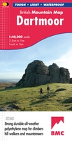 Wandelkaart Dartmoor | Harvey Maps
"This inspiring new map will help walkers and climbers explore Dartmoor's wild granite landscapes, and, like the granite, is virtually indestructible." Sir Ranulph Fiennes, adventurer and explorer. Dartmoor, the …
 Reisgids Devon and Cornwall | Rough Guides
Een kleinere versie in zakformaat van de grotere versies van de Rough Guides. Als altijd weer vol met goede informatie over cultuur en praktische zaken. Achterin een kaart van de …
 Fietskaart Dartmoor | Harvey Maps
New map for cycling on Dartmoor and the surrounding area. 2 maps in one: one side mountain biking the other side for cycle touring Tried and tested cycle …
 Wandelgids South West Coast Path: Somerset & North Devon | Northern Eye Books
Handzame wandelgids met 10 rondwandelingen rond het South West Coast Path. The ten walking routes featured here highlight the best short circular walks along the Somerset and North Devon …
Laatste reviews

Stevige geplastificeerde kaart. Duidelijk, overzichtelijk en makkelijk terug te vouwen.
★★★★★ door Diebje 08 april 2025 | Heeft dit artikel gekocht
Stevige geplastificeerde kaart. Duidelijk, overzichtelijk en makkelijk terug te vouwen.
★★★★★ door Diebje 08 april 2025 | Heeft dit artikel gekocht
Stevige geplastificeerde kaart. Duidelijk, overzichtelijk en makkelijk terug te vouwen.
★★★★★ door Diebje 08 april 2025 | Heeft dit artikel gekocht
Stevige geplastificeerde kaart. Duidelijk, overzichtelijk en makkelijk terug te vouwen. Voor voorpret, napret en alles daartussen.
★★★★★ door Diebje 08 april 2025 | Heeft dit artikel gekocht