Winkelwagen
Geen items in winkelwagen
Ga naar winkelwagen
Wandelkaarten - Frankrijk
Wandelkaarten van Frankrijk kopen voor de perfecte wandelvakantie? Bestel online bij Reisboekwinkel de Zwerver!
De mooiste wandelroutes plannen in Frankijk met behulp van gedetailleerde wandelkaarten
Een wandelvakantie in Frankrijk is een geweldige manier om de prachtige natuur en de rijke cultuur van het land te ontdekken. Het gebruik van wandelkaarten is hierbij essentieel om de mooiste wandelroutes te vinden en veilig te kunnen wandelen. Er zijn verschillende uitgevers die kwalitatieve wandelkaarten aanbieden van Frankrijk, waaronder IGN (Institute Geographique National) en Rando Editions.
Naast wandelkaarten zijn er in Frankrijk ook diverse wandelgidsen beschikbaar die kunnen helpen bij het plannen van een wandelvakantie. Deze gidsen bevatten gedetailleerde informatie over wandelroutes, bezienswaardigheden en andere interessante plekken om te bezoeken. Bekende wandelgidsen voor Frankrijk zijn onder andere de gidsen van FFRP en Elmar.
Overzichtskaarten
-
Overzicht IGN Wandelkaarten 1:75.000


Producten op deze overzichtskaart:
Klik op een product om naar de pagina van dat product te gaan.
- Fietskaart - Wandelkaart 01 Massif du Vercors | IGN - Institut Géographique National
- Fietskaart - Wandelkaart 02 Chartreuse - Belledonne | IGN - Institut Géographique National
- Fietskaart - Wandelkaart 03 Massif de la Vanoise | IGN - Institut Géographique National
- Wandelkaart - Fietskaart 04 Beaufortain - Massif du Mont Blanc | IGN - Institut Géographique National
- Fietskaart - Wandelkaart 05 Briançonnais – Queyras | IGN - Institut Géographique National
- Fietskaart - Wandelkaart 06 Oisans Champsaur - Massif des Ecrins | IGN - Institut Géographique National
- Fietskaart - Wandelkaart 07 Entre Léman et Mont Blanc | IGN - Institut Géographique National
- Fietskaart - Wandelkaart 08 Ubaye, Val d'Allos, Lac de Serre-Poncon | IGN - Institut Géographique National
- Fietskaart - Wandelkaart 09 Diois, Devoluy, Haute-Vallée de la Drôme | IGN - Institut Géographique National
- Fietskaart - Wandelkaart 10 Mercantour | IGN - Institut Géographique National
- Wandelkaart - Fietskaart 11 Cevennes PRN - Gorges du Tarn | IGN - Institut Géographique National
- Fietskaart - Wandelkaart 12 Parc naturel régional Haut-Jura | IGN - Institut Géographique National
- Fietskaart - Wandelkaart 13 Verdon, Lac de Sainte-Croix, Valensole | IGN - Institut Géographique National
- Fietskaart - Wandelkaart 14 Gorges et Monts d'Ardèche - Ardeche | IGN - Institut Géographique National
- Wandelkaart - Fietskaart 15 Chaîne des Puys - Massif du Sancy – Auvergne | IGN - Institut Géographique National
- Wandelkaart - Fietskaart 16 Cézallier – Monts du Cantal | IGN - Institut Géographique National
- Wandelkaart - Fietskaart 17 Golfe du Morbihan | IGN - Institut Géographique National
- Fietskaart - Wandelkaart 18 Vignemale - Pic De Ger - Vallee D'Ossau | IGN - Institut Géographique National
- Fietskaart - Wandelkaart 19 Gavarnie Néouvielle | IGN - Institut Géographique National
- Fietskaart - Wandelkaart 20 Pyrenees Ariegeoises, Mont Valier, Pique d'Estats | IGN - Institut Géographique National
- Fietskaart - Wandelkaart 21 Pyrenees Catalanes, Font Romeu, Massif Canigou Map | IGN - Institut Géographique National
- Fietskaart - Wandelkaart 22 Haut-Languedoc | IGN - Institut Géographique National
- Fietskaart - Wandelkaart 23 Pays Basque | IGN - Institut Géographique National
- Fietskaart - Wandelkaart 24 Bretagne - Pointe du Raz, Presqu'ile de Crozon, Ouessant - les Abers | IGN - Institut Géographique National
- Fietskaart - Wandelkaart 25 Morvan | IGN - Institut Géographique National
- Fietskaart - Wandelkaart 26 Perigord Noir - Haut Quercy | IGN - Institut Géographique National
- Fietskaart - Wandelkaart 27 Vosges du Nord - Mont Sainte Odile - Le Donon | IGN - Institut Géographique National
- Fietskaart - Wandelkaart 28 Vosges du Sud - Ballon d'Alsace - Le Hohneck | IGN - Institut Géographique National
- Fietskaart - Wandelkaart 29 Calvi Cargese Corsica | IGN - Institut Géographique National
- Fietskaart - Wandelkaart 30 Bastia Corte Corsica | IGN - Institut Géographique National
- Fietskaart - Wandelkaart 31 Ajaccio - Porto Vecchio - Corsica | IGN - Institut Géographique National
- Fietskaart - Wandelkaart 32 Chaine des Aravis - Massif des Bauges | IGN - Institut Géographique National
- Fietskaart - Wandelkaart 33 Camargue - Alpilles - Provence | IGN - Institut Géographique National
- Wandelkaart - Fietskaart 34 Luberon - Mont Ventoux | IGN - Institut Géographique National
- Fietskaart - Wandelkaart 35 Ste Victoire - Ste Baume - Calanques - Provence | IGN - Institut Géographique National
- Fietskaart - Wandelkaart 36 Baie De Somme - Cote d'Albatre - Fecamp - Etretat - Normandië | IGN - Institut Géographique National
- Fietskaart - Wandelkaart 37 Bretagne: Saint Malo - Côte d'Emeraude - Mont Saint-Michel | IGN - Institut Géographique National
- Wandelkaart - Fietskaart 38 Île de Ré, Île d'Oléron, Marais Poitevin | IGN - Institut Géographique National
- Wandelkaart - Fietskaart 39 Forêt d'Orient, Lac du Der-Chantecoq | IGN - Institut Géographique National
- Wandelkaart - Fietskaart 40 Massif du Pilat - Monts du Forez | IGN - Institut Géographique National
 Wandelkaart 01 Pays Basque Ouest | Rando Editions
 Wandelkaart 02 Pays Basque Est | Rando Editions★★★★★
 Wandelkaart 03 Béarn - Bearn | Rando Editions★★★★★
 Wandelkaart 04 Bigorre | Rando Editions★★★★★
 Wandelkaart 05 Luchon | Rando Editions
 Wandelkaart 06 Couserans - Val D'aran | Rando Editions
 Wandelkaart 07 Haute Ariege | Rando Editions
 Wandelkaart 08 Cerdagne Capcir | Rando Editions★★★★★
 Wandelkaart 10 Canigou - Garrotxa | Rando Editions★★★★★★★★★★
 Wandelkaart 11 Collioure-Cadaqués | Rando Editions
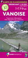 Wandelkaart A3 Vanoise | Rando Editions★★★★★
 Wandelkaart A1 Pays du Mont Blanc | Rando Editions
 Wandelkaart - Topografische kaart 1535SB Blaye | IGN - Institut Géographique National
 Wandelkaart - Topografische kaart 1635SB Guîtres - Coutras | IGN - Institut Géographique National
 Wandelkaart - Topografische kaart 1436SB St-Médard-en-Jalles | IGN - Institut Géographique National
 Wandelkaart - Topografische kaart 1636SB Libourne, Saint-Emilion | IGN - Institut Géographique National
 Wandelkaart - Topografische kaart 1437SB Saint-Jean-d'Illac | IGN - Institut Géographique National
 Topografische kaart - Wandelkaart 1537SB Pessac | IGN - Institut Géographique National
 Wandelkaart - Topografische kaart 1637SB Podensac | IGN - Institut Géographique National
 Wandelkaart - Topografische kaart 1438SB Belin-Béliet | IGN - Institut Géographique National
- 1
- 2
- 3
- Volgende >>
- 60
De mooiste wandelgebieden ontdekken in Frankrijk met de juiste wandelkaarten
Frankrijk heeft veel prachtige wandelgebieden die de moeite waard zijn om te verkennen. Of u nu houdt van glooiende heuvels, ruige natuur of schilderachtige dorpjes, er is voor ieder wat wils. Neem bijvoorbeeld de Franse Alpen, de meest spectaculaire berglandschappen in Europa, met talloze wandelroutes die door de bergen lopen. Populaire gebieden zijn onder andere de Mont Blanc-massief, de Vanoise en de Ecrins.
Een ander schitterend wandelgebied is de Provence. Deze regio staat bekend om het mediterrane klimaat en pittoreske landschappen. Wandelaars kunnen genieten van prachtige routes langs lavendelvelden, olijfgaarden en wijngaarden, en door schilderachtige dorpjes en historische steden.
Of neem de Loire-vallei, wat bekend staat om de oude kastelen en prachtige landschappen langs de rivier de Loire. De zeer nauwkeurige en gedetailleerde wandelkaarten series Top25 en Serie Bleue van IGN zijn perfect voor een fijne wandelvakantie in deze gebieden.
Of neem de Loire-vallei, wat bekend staat om de oude kastelen en prachtige landschappen langs de rivier de Loire. De zeer nauwkeurige en gedetailleerde wandelkaarten series Top25 en Serie Bleue van IGN zijn perfect voor een fijne wandelvakantie in deze gebieden.
Ontdek welke schaal wandelkaarten het beste past bij uw wandelvakantie in Frankrijk
Frankrijk heeft een grote verscheidenheid aan landschappen en daarom is het belangrijk om de juiste schaal van wandelkaarten te kiezen. Voor wandelaars in Frankrijk wordt meestal een kaartschaal van 1:25.000 of 1:50.000 aanbevolen. Een schaal van 1:25.000 biedt meer details, waardoor u nauwkeuriger de route kunt plannen en volgen, terwijl een schaal van 1:50.000 meer gebied beslaat en daardoor geschikter is voor een meerdaagse tocht.
Uitgevers zoals IGN en Rando Editions bieden een uitgebreid aanbod aan wandelkaarten van verschillende schalen en regio's in Frankrijk.
Met gedetailleerde wandelkaarten van Frankrijk ontdekt u de mooiste plekken!
In onze webshop kunt u overzichtelijke wandelkaarten kopen van verschillende gebieden in Frankrijk. Deze uitgevers hebben kaarten uitgebracht die een groot deel van Frankrijk dekken:
- Top 25 van IGN
- Serie Bleue van IGN
- Rando Editions
De beste wandelkaarten over Frankrijk kunt u online bestellen bij Reisboekwinkel de Zwerver voor de mooiste wandeltochten.
Laatste reviews

Beetje lastige routes
Niet echt voor beginners. Ook zijn de routes soms moeilijk qua logistiek. Weer terugkomen aan het eind bv. En in voorseizoen (mei) blijft er niet …
★★★★★ door Tjeerd 17 mei 2024 | Heeft dit artikel gekocht
Goede service
Van te voren had ik een andere kaart op het oog. Toen ik in de winkel was adviseerde zij mij deze kaart. Op hun verzoek …
★★★★★ door Koen 17 mei 2024 | Heeft dit artikel gekocht
Goede kaart op fijne schaal
Ideale schaal waar ook de kleinere wegen duidelijk zijn aangegeven. Beschrijving op website is correct.
★★★★★ door Peter 16 mei 2024 | Heeft dit artikel gekocht
Fijne kaart
Overzichtelijke kaart. Niks op aan te merken.
★★★★★ door Bastiaan de Leeuw 16 mei 2024 | Heeft dit artikel gekocht