Winkelwagen
Geen items in winkelwagen
Ga naar winkelwagen
Topografische kaarten - Picardie - Noordwest Frankrijk
Overzichtskaarten
-
Overzicht IGN 25.000 Pays de Calais - Picardië: Noord


Producten op deze overzichtskaart:
Klik op een product om naar de pagina van dat product te gaan.
- Wandelkaart - Topografische kaart 2103ET Calais | IGN - Institut Géographique National
- Wandelkaart - Topografische kaart 2104ET Boulogne-Sur-Mer | IGN - Institut Géographique National
- Wandelkaart - Topografische kaart 2105ET Le Touquet-Paris-Plage, Berck, Étaples, Vallée de la Canche | IGN - Institut Géographique National
- Wandelkaart - Topografische kaart 2106ET Baie de Somme, Le Crotoy, Fort-Mahon-Plage | IGN - Institut Géographique National
- Wandelkaart - Topografische kaart 2107OT Le Tréport | IGN - Institut Géographique National
- Wandelkaart - Topografische kaart 2203SB Gravelines - Andruicq | IGN - Institut Géographique National
- Wandelkaart - Topografische kaart 2204SB Lumbres - Fruges | IGN - Institut Géographique National
- Wandelkaart - Topografische kaart 2206SB Hesdin, Auxi-le-Château | IGN - Institut Géographique National
- Wandelkaart - Topografische kaart 2207SB Abbeville, Domart-en-Ponthieu | IGN - Institut Géographique National
- Topografische kaart - Wandelkaart 2302SB Dunkerque - Gravelines | IGN - Institut Géographique National
- Wandelkaart - Topografische kaart 2303SB Wormhout - Cassel - Watten | IGN - Institut Géographique National
- Wandelkaart - Topografische kaart 2304SB Aire-Sur-La-Lys, St-Omer | IGN - Institut Géographique National
- Wandelkaart - Topografische kaart 2305SB Lillers - Heuchin | IGN - Institut Géographique National
- Wandelkaart - Topografische kaart 2306SB Saint-Michel-Sur-Ternoise, Frévent | IGN - Institut Géographique National
- Wandelkaart - Topografische kaart 2307SB Doullens - Beauval | IGN - Institut Géographique National
- Wandelkaart - Topografische kaart 2402SB Hondschoote - Bergues | IGN - Institut Géographique National
- Wandelkaart - Topografische kaart 2403SB Steenvoorde - Bailleul | IGN - Institut Géographique National
- Wandelkaart - Topografische kaart 2404SB Armentieres - Hazebrouck | IGN - Institut Géographique National
- Wandelkaart - Topografische kaart 2405SB Lens - Béthune | IGN - Institut Géographique National
- Wandelkaart - Topografische kaart 2406SB Arras, Avesnes-le-Comte | IGN - Institut Géographique National
- Wandelkaart - Topografische kaart 2407SB Bapaume, Acheux-en-Amiénois | IGN - Institut Géographique National
- Wandelkaart - Topografische kaart 2504SB Lille - Roubaix - Tourcoing | IGN - Institut Géographique National
- Wandelkaart - Topografische kaart 2505SB Leforest - Cysoing - Hénin-Beaumont - Carvin | IGN - Institut Géographique National
- Wandelkaart - Topografische kaart 2506SB Douai - Rouvroy - Vitry-en-Artois | IGN - Institut Géographique National
- Wandelkaart - Topografische kaart 2507SB Cambrai - Bertincourt | IGN - Institut Géographique National
- Wandelkaart - Topografische kaart 2606SB Valenciennes - Denain | IGN - Institut Géographique National
- Wandelkaart - Topografische kaart 2607SB Le Cateau-Cambrésis, Caudry | IGN - Institut Géographique National
- Wandelkaart - Topografische kaart 2706OT Foret De Mormal | IGN - Institut Géographique National
- Wandelkaart - Topografische kaart 2806SB Jeumont - Maubeuge | IGN - Institut Géographique National
-
Overzicht IGN 25.000 Pays de Calais - Picardië: Zuid


Producten op deze overzichtskaart:
Klik op een product om naar de pagina van dat product te gaan.
- Wandelkaart - Topografische kaart 2208SB Picquigny, Hallencourt, Molliens-Dreuil | IGN - Institut Géographique National
- Wandelkaart - Topografische kaart 2209SB Poix-de-Picardie, Hornoy-le-Bourg | IGN - Institut Géographique National
- Wandelkaart - Topografische kaart 2210SB Crèvecoeur-le-Grand, Grandvilliers | IGN - Institut Géographique National
- Wandelkaart - Topografische kaart 2211SB Gournay-en-Bray , Lachapelle-aux-Pots | IGN - Institut Géographique National
- Wandelkaart - Topografische kaart 2212SB Méru, Chaumont-en-Vexin | IGN - Institut Géographique National
- Wandelkaart - Topografische kaart 2308SB Corbie - Amiens | IGN - Institut Géographique National
- Wandelkaart - Topografische kaart 2309SB Moreuil - Saleux | IGN - Institut Géographique National
- Wandelkaart - Topografische kaart 2310SB Saint-Just-en-Chaussée , Breteuil | IGN - Institut Géographique National
- Wandelkaart - Topografische kaart 2311SB Beauvais - Mouy | IGN - Institut Géographique National
- Wandelkaart - Topografische kaart 2312ET Clermont - Creil | IGN - Institut Géographique National
- Wandelkaart - Topografische kaart 2408SB Bray-sur-Somme, Albert | IGN - Institut Géographique National
- Wandelkaart - Topografische kaart 2409SB Roye | IGN - Institut Géographique National
- Wandelkaart - Topografische kaart 2410SB Ressons-sur-Matz, Montdidier | IGN - Institut Géographique National
- Wandelkaart - Topografische kaart 2411SB Estrées-St-Denis, Clermont | IGN - Institut Géographique National
- Wandelkaart - Topografische kaart 2412OT Forêt de Chantilly | IGN - Institut Géographique National
- Wandelkaart - Topografische kaart 2508SB Roisel - Péronne | IGN - Institut Géographique National
- Wandelkaart - Topografische kaart 2509SB Ham - Nesle | IGN - Institut Géographique National
- Wandelkaart - Topografische kaart 2510SB Chauny - Noyon | IGN - Institut Géographique National
- Wandelkaart - Topografische kaart 2511OT Forêts de Compiègne | IGN - Institut Géographique National
- Wandelkaart - Topografische kaart 2512OT Villers-Cotterêts | IGN - Institut Géographique National
- Wandelkaart - Topografische kaart 2608SB Bohain-en-Vermandois, Guise | IGN - Institut Géographique National
- Wandelkaart - Topografische kaart 2609SB Ribemont - Saint Quentin | IGN - Institut Géographique National
- Wandelkaart - Topografische kaart 2610SB Tergnier, Forêt de St-Gobain et Coucy Basse | IGN - Institut Géographique National
- Wandelkaart - Topografische kaart 2611SB Braine - Soissons | IGN - Institut Géographique National
- Wandelkaart - Topografische kaart 2612SB Fère-en-Tardenois, Neuilly-St-Front | IGN - Institut Géographique National
- Wandelkaart - Topografische kaart 2613SB Château-Thierry, Charly-sur-Marne | IGN - Institut Géographique National
- Wandelkaart - Topografische kaart 2708SB Le Nouvion-en-Thiérache, Avesnes-sur-Helpe | IGN - Institut Géographique National
- Wandelkaart - Topografische kaart 2709SB Vervins - Marie | IGN - Institut Géographique National
- Wandelkaart - Topografische kaart 2710SB Sissonne - Laon | IGN - Institut Géographique National
- Wandelkaart - Topografische kaart 2808SB Hirson - Fourmies | IGN - Institut Géographique National
 Wandelkaart - Topografische kaart 2103ET Calais | IGN - Institut Géographique National★★★★★
 Wandelkaart - Topografische kaart 2104ET Boulogne-Sur-Mer | IGN - Institut Géographique National★★★★★
 Wandelkaart - Topografische kaart 2402SB Hondschoote - Bergues | IGN - Institut Géographique National
 Wandelkaart - Topografische kaart 2203SB Gravelines - Andruicq | IGN - Institut Géographique National
 Wandelkaart - Topografische kaart 2303SB Wormhout - Cassel - Watten | IGN - Institut Géographique National
 Wandelkaart - Topografische kaart 2403SB Steenvoorde - Bailleul | IGN - Institut Géographique National
 Wandelkaart - Topografische kaart 2204SB Lumbres - Fruges | IGN - Institut Géographique National
 Wandelkaart - Topografische kaart 2304SB Aire-Sur-La-Lys, St-Omer | IGN - Institut Géographique National
 Wandelkaart - Topografische kaart 2404SB Armentieres - Hazebrouck | IGN - Institut Géographique National
 Wandelkaart - Topografische kaart 2504SB Lille - Roubaix - Tourcoing | IGN - Institut Géographique National
 Wandelkaart - Topografische kaart 2107OT Le Tréport | IGN - Institut Géographique National★★★★★
 Wandelkaart - Topografische kaart 2106ET Baie de Somme, Le Crotoy, Fort-Mahon-Plage | IGN - Institut Géographique National★★★★★
 Wandelkaart - Topografische kaart 2512OT Villers-Cotterêts | IGN - Institut Géographique National
 Wandelkaart - Topografische kaart 2511OT Forêts de Compiègne | IGN - Institut Géographique National★★★★★
 Wandelkaart - Topografische kaart 2412OT Forêt de Chantilly | IGN - Institut Géographique National★★★★★
 Wandelkaart - Topografische kaart 2105ET Le Touquet-Paris-Plage, Berck, Étaples, Vallée de la Canche | IGN - Institut Géographique National
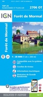 Wandelkaart - Topografische kaart 2706OT Foret De Mormal | IGN - Institut Géographique National★★★★★
 Wandelkaart - Topografische kaart 2305SB Lillers - Heuchin | IGN - Institut Géographique National
 Wandelkaart - Topografische kaart 2405SB Lens - Béthune | IGN - Institut Géographique National
 Wandelkaart - Topografische kaart 2505SB Leforest - Cysoing - Hénin-Beaumont - Carvin | IGN - Institut Géographique National
Laatste reviews

Beetje lastige routes
Niet echt voor beginners. Ook zijn de routes soms moeilijk qua logistiek. Weer terugkomen aan het eind bv. En in voorseizoen (mei) blijft er niet …
★★★★★ door Tjeerd 17 mei 2024 | Heeft dit artikel gekocht
Goede service
Van te voren had ik een andere kaart op het oog. Toen ik in de winkel was adviseerde zij mij deze kaart. Op hun verzoek …
★★★★★ door Koen 17 mei 2024 | Heeft dit artikel gekocht
Goede kaart op fijne schaal
Ideale schaal waar ook de kleinere wegen duidelijk zijn aangegeven. Beschrijving op website is correct.
★★★★★ door Peter 16 mei 2024 | Heeft dit artikel gekocht
Fijne kaart
Overzichtelijke kaart. Niks op aan te merken.
★★★★★ door Bastiaan de Leeuw 16 mei 2024 | Heeft dit artikel gekocht