Categorieën
- Nieuwe artikelen
- Boeken
-
Kaarten
- Camperkaarten
- Educatieve kaarten
- Fietskaarten
- Fietsknooppuntenkaarten
- Historische Kaarten
- Pelgrimsroutes (kaarten)
- Spoorwegenkaarten
- Stadsplattegronden
- Toerskikaarten
- Topografische kaarten
- Wandelatlassen
-
Wandelkaarten
- Afrika
- Azië
-
Europa
- Albanië
- Andorra
- Armenië
- België
- Bulgarije
- Cyprus
- Denemarken
- Duitsland
- Engeland
- Faroer
- Finland
- Frankrijk
- Georgië
- Griekenland
- IJsland
- Ierland
- Italië
- Kosovo
- Kroatië
- Letland
- Liechtenstein
- Luxemburg
- Malta
- Montenegro
- Nederland
- Noord-Ierland
- Noord-Macedonië
- Noorwegen
- Oekraïne
- Oostenrijk
- Polen
- Portugal
- Roemenië
- Rusland
- Schotland
- Servië
- Slovenië
- Slowakije
-
Spanje
- Noordwest Spanje - Galicië - Asturië
- Galicië
- Asturië
- Cantabrië
- ♦ Picos de Europa
- Castilië en León
- La Rioja
- 🥾 Wandelroute Santiago de Compostela
- Aragon
- Catalonië
- ♦ Costa Brava
- Spaanse Pyreneeën
- 🥾 GR-11 La Senda Trektocht
- Extremadura
- Centraal Spanje
- Spanje oost - Costa Blanca
- Valencia (autonome regio)
- ♦ Costa Blanca
- Murcia
- Andalusië - Zuid Spanje
- ♦ Sierra Nevada - Alpujarras
- Mallorca
- Menorca
- Ibiza
- Canarische Eilanden
- Tenerife
- Gran Canaria
- La Gomera
- La Palma
- El Hierro
- Lanzarote
- Fuerteventura
- Barcelona
- Tsjechië
- Turkije
- Zweden
- Zwitserland
- Midden-Amerika
- Midden-Oosten
- Noord-Amerika
- Oceanië
- Zuid-Amerika
- Wandelknooppuntenkaarten
- Waterkaarten
- Wegenatlassen
- Wegenkaarten
- Wintersportkaarten
- Opruiming
- Puzzels
- Travel Gadgets
- Wandkaarten
- Wereldbollen
Veilig online betalen
Betaal veilig via uw eigen bankomgeving
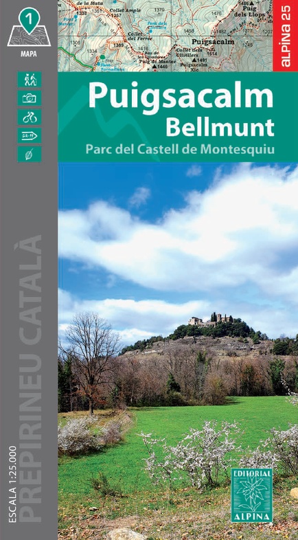
Wandelkaart Puigsacalm Bellmunt - | Editorial Alpina (9788470111280)
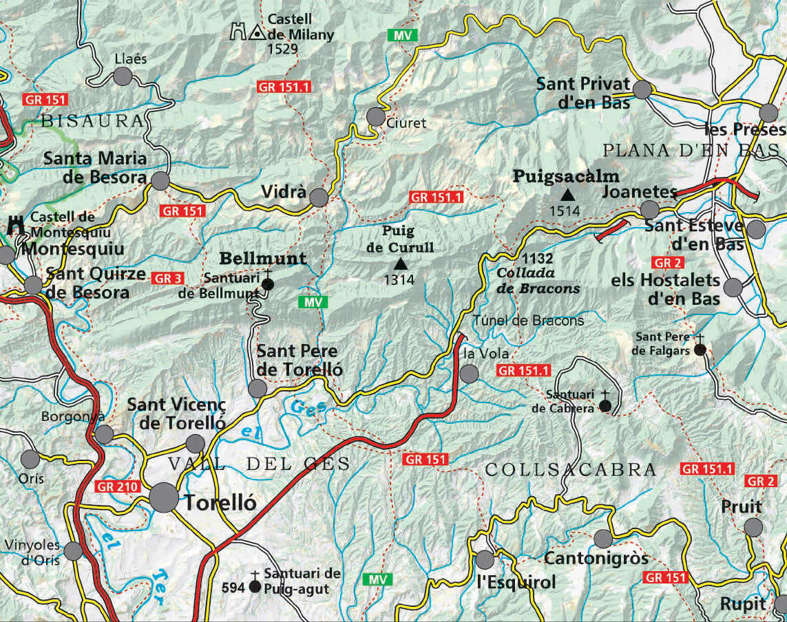
Parc Castell de Montesquiu
- ISBN / CODE: 9788470111280
- Editie: 01-10-2024
- Aantal blz.: 1
- Schaal: 1:25000
- Uitgever: Editorial Alpina
- Soort: Wandelkaart
- Taal: Engels
- Hoogte: 21.0 cm
- Breedte: 12.0 cm
- Gewicht: 100.0 g
- Bindwijze: -
- Uitvoering: Papier
- Schrijf als eerste een review
-
€ 17,95
Dit artikel is (tijdelijk) niet leverbaar Dit artikel is (tijdelijk) niet leverbaar
- Afbeeldingen
- Inkijkexemplaar
Beschrijving
Van de uitgever
Book Language: Catalan
•Hiking map and guidebook
•Scale 1:25.000
•Equidistance contours: 10 m distance
•Master contours: at 50 m
•Shady relief
•Compatible with GPS
•Marked routes
•Land use symbolized at three levels
•Guidebook with hikes, potholing, gully descent, climbing, mountain biking and all the facts of interest
Reviews
Geen reviews gevonden voor dit product.
Schrijf een review
Graag horen wij wat u van dit artikel vindt. Vindt u het goed, leuk, mooi, slecht, lelijk, onbruikbaar of erg handig: schrijf gerust alles op! Het is niet alleen leuk om te doen maar u informeert andere klanten er ook nog mee!
Ook interessant voor europa/spanje/catalonie
-
Wegenkaart - landkaart Mapa Provinci
€ 9,95Wegenkaarten Catalonië -
Wandelkaart Sant Llorenç de Montgai,
€ 14,95Wandelkaarten Catalonië -
Woordenboek Kauderwelsch Katalanisch
€ 9,50Woordenboeken & Taalgidsen Catalonië -
Reisgids Marco Polo NL Costa Brava |
€ 14,95Reisgidsen Catalonië -
Wandelgids GR 175 Catalunya - Ruta d
€ 18,95Wandelgidsen Catalonië