Ultramap XT40
De ultieme Harvey XT40 wandelkaart voor alle avonturen!
De UltraMap XT40-serie is een superlichte, waterdichte set kaarten in zakformaat die enkele van de meest populaire gebieden in het Verenigd Koninkrijk bestrijkt met een schaal van 1:40.000. Deze zijn ideaal voor hardlopers, fastpackers en wandelaars die een kaart willen voor eenvoudige navigatie bij het afleggen van langere afstanden.
Eigenschappen
- Heeft de voordelen van zijn grotere broers
- Volledig gedetailleerde echte HARVEY-mapping
- Gebruik zonder kaarthoes: stevig en 100% waterdicht
- Opent direct aan beide zijden van het blad
- Gewicht: 24g
- Schaal: 1:40.000
- Verhouding: 2,5 cm = 1 km
- Plat formaat: 870 x 304 mm (87 x 30,4 cm)
- Afmetingen opgevouwen: 73 x 152 mm (7,3 x 15,2 cm)
- Kaartgebied: 700 vierkante kilometer
- Dubbelzijdig: ja
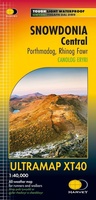 Wandelkaart Snowdonia Central | Harvey Maps
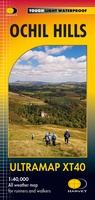 Wandelkaart Ochil Hills | Harvey Maps
Pocket perfect! Well known hills are Dumyat, Ben Cleuch and Castle Craig Hill. Magnificent views over the Forth Valley. Places of interest and enlargements of the steep and narrow glens: …
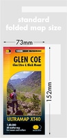 Wandelkaart Glen Coe | Harvey Maps
Covers a large area yet is handily compact. Pocket perfect! Detailed map for runners and walkers of Glen Coe and the Aonach Eagach ridge at the magic scale of …
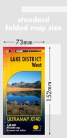 Wandelkaart Lake District West | Harvey Maps
HARVEY launch innovative new series: Ultramap XT40. 16 titles featuring in Trail magazine through spring 2016. 40 years experience have gone into HARVEY's most creative new series. The Ultramap covers …
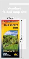 Wandelkaart Peak District Zuid | Harvey Maps
HARVEY launch innovative new series: Ultramap XT40. 16 titles featuring in Trail magazine through spring 2016. 40 years experience have gone into HARVEY's most creative new series. The Ultramap covers …
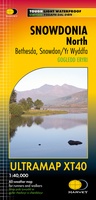 Wandelkaart Snowdonia Noord | Harvey Maps★★★★★
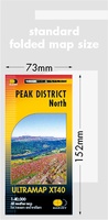 Wandelkaart Peak District Noord | Harvey Maps
HARVEY launch innovative new series: Ultramap XT40. 16 titles featuring in Trail magazine through spring 2016. 40 years experience have gone into HARVEY's most creative new series. The Ultramap covers …
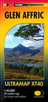 Wandelkaart Glen Affric | Harvey Maps
Covers a large area yet is handily compact. Pocket perfect! Detailed map for runners and walkers of the remote Glen Affric area at the magic scale of 1:40,000. …
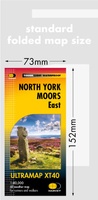 Wandelkaart North York Moors Oost | Harvey Maps
Covers a large area yet is handily compact. Pocket perfect! Detailed map for runners and walkers of the eastern section of the North York Moors National Park at the …
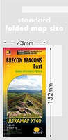
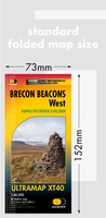 Wandelkaart Brecon Beacons West | Harvey Maps
Covers a large area yet is handily compact. Pocket perfect! Detailed map for runners and walkers of the western part of the Brecon Beacons National Park at the magic …
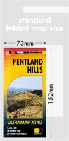 Wandelkaart Pentland Hills | Harvey Maps
Covers a large area yet is handily compact. Pocket perfect!Detailed map for runners and walkers of the whole of the Pentlands at the magic scale of 1:40,000 on one side …
 Wandelkaart Snowdonia Zuid | Harvey Maps
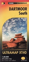 Wandelkaart Dartmoor Zuid | Harvey Maps
Covers a large area yet is handily compact. Pocket perfect! Detailed map for runners and walkers of the south section of Dartmoor National Park at the magic scale of …
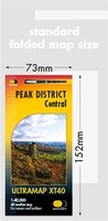 Wandelkaart Peak District Central | Harvey Maps
HARVEY launch innovative new series: Ultramap XT40. 16 titles featuring in Trail magazine through spring 2016. 40 years experience have gone into HARVEY's most creative new series. The Ultramap covers …
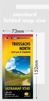 Wandelkaart Trossachs Noord | Harvey Maps
Covers a large area yet is handily compact. Pocket perfect! Detailed map for runners and walkers of the northern section of the Trossachs National Park at the magic scale …
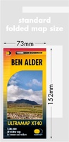 Wandelkaart Ben Alder | Harvey Maps
Covers a large area yet is handily compact. Pocket perfect!Detailed map for runners and walkers of the hills between Loch Tay and Loch Rannoch at the magic scale of 1:40,000.Includes …
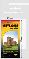 Wandelkaart Crieff & Comrie | Harvey Maps
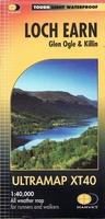 Wandelkaart Loch Earn | Harvey Maps
Covers a large area yet is handily compact. Pocket perfect! Detailed map for runners and walkers of Loch Earn, Glen Ogle and Killin at the magic scale of 1:40,000. …
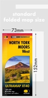 Wandelkaart North York Moors West | Harvey Maps
Covers a large area yet is handily compact. Pocket perfect! Detailed map for runners and walkers of the western section of the North York Moors National Park at the …
 Wandelkaart Brecon Beacons Oost | Harvey Maps
Covers a large area yet is handily compact. Pocket perfect! Detailed map for runners and walkers of the eastern part of the Brecon Beacons National Park and the Black …
Laatste reviews

Tot nu toe één stuk van de route gelopen. De route was duidelijk met leuke informatie over de plekken waar doorheen of langsgelopen werd. Het …
★★★★★ door Dana 29 maart 2025 | Heeft dit artikel gekocht
ik ben erg tevreden met mijn aankoop bij de zwerver, het was heel snel geleverd en de kaart is top
★★★★★ door luc van Esch 28 maart 2025 | Heeft dit artikel gekocht
Informatief boek, keurig en snel geleverd!
★★★★★ door World Explorers 28 maart 2025 | Heeft dit artikel gekocht
Heeft een duidelijk beeld van alle eilanden waardoor het makkelijk kiezen is
★★★★★ door Carla Van Den Eeckhoudt 28 maart 2025 | Heeft dit artikel gekocht