Wegenatlassen
Wegenatlas kopen? De perfecte routeplanner op reis koopt u gemakkelijk online bij Reisboekwinkel de Zwerver!
Wegenatlassen zijn de wat uitvoerige vorm van wegenkaarten. Een wegenatlas ligt meestal in de auto en fungeertals handig opzoekmiddel, vooral voor reizigers die langere afstanden willen afleggen. Bijvoorbeeld als u met het gezin door Frankrijk rijdt, of met vierwielaandrijving Zuid-Afrika wil verkennen.
 Wegenatlas Navigator Britain - Engeland en Schotland 1:100.000 | Philip's Maps
Bijzonder gedetaileerde wegenatlas van Engeland en Schotland op schaal 1:100.000 (met het noorden van Schotland 1:200.000). Alle wegen, bezienswaardigheden, National Trails, campings ... noem maar op en je vindt het …
★★★★★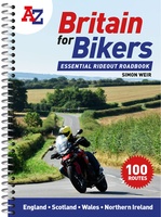 Wegenatlas Britain for Bikers | Voor Motoren | A-Z Map Company
Discover the best biking routes around Great Britain and Northern Ireland. Your essential rideout roadbook covering the best biking routes around Great Britain and Northern Ireland, including short trips and …
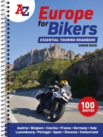 Wegenatlas A -Z Europe for Bikers | Voor Motoren | A-Z Map Company
Discover the best biking routes around Europe. The definitive European motorcycle touring bible, with the best biking roads presented in 100 easy-to-follow, tried-and-tested routes from motorcycle journalist, author and traveller …
 Wegenatlas Europa | Falk
Duidelijke en overzichtelijke atlas van Europa. Ideal für die großen Urlaubsfahrten - Der "Falk Reiseatlas Europa" zeigt alle wichtigen Reiserouten vom Nordkap bis Sizilien und von Lissabon bis Ankara. …
 Wegenatlas Island - IJsland | Freytag & Berndt
Bijzonder gedetaileerde wegenatlas van IJsland . Handig in ringband. Der Reiseatlas Island 1:150.000 ist der ideale Wegbegleiter für alle, die Island mit dem Auto oder öffentlichen Verkehrsmitteln erkunden möchte. Er …
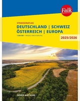 Wegenatlas Falk Straßenatlas 2025-2026 Deutschland, Österreich, Schweiz 1:300 000 | Falk Ostfildern
Der Falk Straßenatlas Deutschland wird ergänzt durch die beiden angrenzenden Reiseländer Österreich und Schweiz. In dem Detailmaßstab 1:300 000 sind selbst kleine Orte zu finden.Die praktische Spiralbindung sorgt zusätzlich für …
 Wegenatlas Big Easy Read Britain 2024 | A3 | Ringband | AA Publishing
AA Publishing brings you the UK’s most up-to-date road atlases Over 100 years of mapping your journeys • Giant scale mapping at 2.5 miles to 1 inch = 1:25,000 • …
 Wegenatlas Road Atlas Britain and Ireland 2024 | Philip's Maps
PHILIP'S - Market leaders and No. 1 in the UK for clear maps'Good balance between detail and clarity with excellent town maps' What Car? * Super-clear mapping at a scale …
★★★★★ Wegenatlas Großer Alpenstraßenführer, 28. Ausgabe | Denzel Verlag
Das international bewährte Standardwerk für sportlich-touristisch eingestellte Auto- und Zweiradfahrer! Aus der Vielzahl anfahrbarer Hochpunkte innerhalb des weiten Alpenbogens von Wien bis Marseille wurden rund 700 der interessantesten Hochstraßen und …
 Wegenatlas Big Road Atlas Britain 2024 - A3 | Ringband | AA Publishing
This best-selling A3 format atlas is available two binding styles; softback and spiral bound. Each page has been titled with its geographical location so you can turn to the page …
★★★★★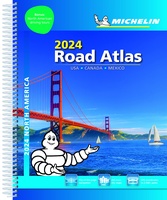 Wegenatlas Road Atlas USA Canada Mexico 2024 | A4-Formaat | Ringband | Michelin
De beroemde wegenatlas van Rand McNally nu als Michelin atlas. Super handige atlas van Michelin in A4 formaat met stevige ringband. Let op: Canada en Mexico staan er zeer beperkt in. …
 Wegenatlas Great Britain and Northern Ireland Road Atlas 2024 | A-Z Map Company
A full-colour, paperback road atlas of Great Britain, now fully revised and updated. Clear detailed road mapping at a scale of 3.5 miles to 1 inch. Presented in a large, …
 Wegenatlas - Stadsplattegrond Bristol and Bath Streetatlas | A-Z Map Company
Navigate your way around Bristol and Bath with this detailed and easy-to-use A-Z Street Atlas. Printed in full-colour, paperback format, this atlas contains 104 pages of continuous street mapping. More …
★★★★★ Wegenatlas Philip's Easy to Read Road Atlas of Britain 2025 | A3-Formaat | Paperback | Philip's Maps
With the detail you need at a size you can read, the latest edition of 2025 Philip's Big Easy to Read Road Atlas of Britain is super-clear, super-sized and bang …
 Wegenatlas AA Glovebox Atlas Britain | AA Publishing
This handy atlas fits in the glovebox of your car, perfect for quick referencing on the move. The clear mapping includes a range of essential motoring and useful touring information …
 Wegenatlas Nederland | ANWB Media
In deze nieuwe editie van de ANWB Wegenatlas Nederland (ringband)is het kaartwerk geactualiseerd. Met een schaal van 1:100.000 (1 cm = 1 km) voldoet de atlas aan de wensen van …
★★★★★★★★★★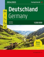 Wegenatlas Deutschland - Germany - Duitsland 2024-2025 | Freytag & Berndt
Der Straßenatlas "Deutschland 1:200.000" ist der ideale Wegbegleiter für alle die in Deutschland mit dem Auto unterwegs sind und dabei nicht nur Autobahnen und Schnellstraßen nutzen möchten.Mit dem detailreichen Kartenbild …
★★★★★ Wegenatlas IJsland met stadsplattegronden | Ferdakort
Super handige kleine wegenatlas van IJsland (schaal 1:500.000) met vooral een enorme hoeveelheid plattegronden van steden en dorpen, enkele themakaarten en een groot register. De kaarten zijn uitstekend leesbaar en …
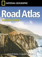 Wegenatlas USA Canada Mexico Road Atlas | A4-Formaat | National Geographic
National Geographic's Road Atlas: Scenic Drives Edition, is the ideal companion for the next time you hit the road for an unforgettable road trip. Includes up-to-date road maps for all …
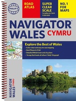 Wegenatlas Wales Navigator | A4 | Ringband | Philip's Maps
Ideaal voor fietsers! Explore the many attractions of Wales with this easy-to-use road atlas showing all the top spots. Easy-to-read mapping, superb extra detail, and a great lie-flat format make …
Waar moet je op letten als je een goede wegenatlas wilt kopen?
Scheur- en watervaste of een papieren wegenatlas?
Welke schaal van een wegenatlas heb ik nodig?
De leesbaarheid van een wegenatlas
Ringband of gebonden
Wat moet er op een wegenatlas staan?
Kies altijd de meest recente editie van een wegenatlas
Welk formaat wegenatlas heb ik nodig?
Laatste reviews

Niet echt voor beginners. Ook zijn de routes soms moeilijk qua logistiek. Weer terugkomen aan het eind bv. En in voorseizoen (mei) blijft er niet …
★★★★★ door Tjeerd 17 mei 2024 | Heeft dit artikel gekocht
Van te voren had ik een andere kaart op het oog. Toen ik in de winkel was adviseerde zij mij deze kaart. Op hun verzoek …
★★★★★ door Koen 17 mei 2024 | Heeft dit artikel gekocht
Ideale schaal waar ook de kleinere wegen duidelijk zijn aangegeven. Beschrijving op website is correct.
★★★★★ door Peter 16 mei 2024 | Heeft dit artikel gekocht
Overzichtelijke kaart. Niks op aan te merken.
★★★★★ door Bastiaan de Leeuw 16 mei 2024 | Heeft dit artikel gekocht