Winkelwagen
Geen items in winkelwagen
Ga naar winkelwagen
Topografische kaarten - Aquitaine
 Wandelkaart - Topografische kaart 1545 SB - Serie Bleue Oloron – Sainte-Marie | IGN - Institut Géographique National
 Topografische kaart - Wandelkaart 1645 Pontacq - Ossun - Ger | IGN - Institut Géographique National
 Wandelkaart - Topografische kaart 2033 SB - Serie Bleue Saint-Yrieix-La Perche-Lubersac | IGN - Institut Géographique National
 Wandelkaart - Topografische kaart 1734 SB - Serie Bleue Ribérac - Chalais | IGN - Institut Géographique National
 Wandelkaart - Topografische kaart 1433 SB - Serie Bleue Lesparre-Médoc | IGN - Institut Géographique National
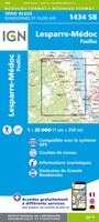 Wandelkaart - Topografische kaart 1434 SB - Serie Bleue Lesparre-Médoc | IGN - Institut Géographique National
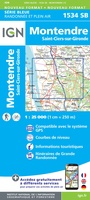 Topografische kaart - Wandelkaart 1534 SB - Serie Bleue Montendre, St-Ciers-sur-Girond | IGN - Institut Géographique National
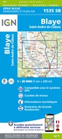 Wandelkaart - Topografische kaart 1535 SB - Serie Bleue Blaye | IGN - Institut Géographique National
 Wandelkaart - Topografische kaart 1635 SB - Serie Bleue Guîtres - Coutras | IGN - Institut Géographique National
 Wandelkaart - Topografische kaart 2037OT Roque-Gageac, Domme | IGN - Institut Géographique National★★★★★
 Wandelkaart - Topografische kaart 1344OT Bayonne | IGN - Institut Géographique National
 Wandelkaart - Topografische kaart 1343OT Capbreton | IGN - Institut Géographique National
 Wandelkaart - Topografische kaart 1341ET Castets | IGN - Institut Géographique National
 Wandelkaart - Topografische kaart 1340ET Mimizan | IGN - Institut Géographique National
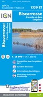 Wandelkaart - Topografische kaart 1339ET Biscarrosse | IGN - Institut Géographique National
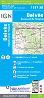 Wandelkaart - Topografische kaart 1937 SB - Serie Bleue Belves, Beaumont-du-Périgord | IGN - Institut Géographique National★★★★★
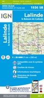 Wandelkaart - Topografische kaart 1936 SB - Serie Bleue Lalinde, le Buisson-de-Cadouin | IGN - Institut Géographique National
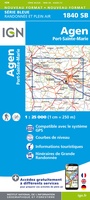 Topografische kaart - Wandelkaart 1840 SB - Serie Bleue Agen | IGN - Institut Géographique National
 Wandelkaart - Topografische kaart 1433OT Soulac-Sur-Mer & Montalivet Pointe De Grave | IGN - Institut Géographique National
 Topografische kaart - Wandelkaart 1434OT Hourtin, Lacs d'Hourtin Et De Carcans | IGN - Institut Géographique National
Laatste reviews

Top advies, prima product
Voor mijn werk was ik op zoek naar een goede stadsplattegrond van Utrecht maar daar worden er meerdere van aangeboden dus maar gevraagd welke ik …
★★★★★ door Rene Gans 31 maart 2025 | Heeft dit artikel gekocht
Prima zaak
Snel en goede behandeling bestelling goede kwaliteit van product ben zeker tevreden
★★★★★ door Andre 31 maart 2025 | Heeft dit artikel gekocht
Duidelijke routebeschrijving met leuke informatie over omgeving
Tot nu toe één stuk van de route gelopen. De route was duidelijk met leuke informatie over de plekken waar doorheen of langsgelopen werd. Het …
★★★★★ door Dana 29 maart 2025 | Heeft dit artikel gekocht
heel fijne kaart
ik ben erg tevreden met mijn aankoop bij de zwerver, het was heel snel geleverd en de kaart is top
★★★★★ door luc van Esch 28 maart 2025 | Heeft dit artikel gekocht